


Forecast for the Abajos Area Mountains

Issued by Eric Trenbeath on
Monday morning, March 1, 2021
Monday morning, March 1, 2021
You can still trigger deep and dangerous avalanches on steep NW-N-SE aspects and the avalanche danger is a solid MODERATE in these areas. The danger increases with elevation where wind drifted snow has added stress to buried persistent weak layers. Avoid areas where the snowpack is thinner as this is where it is possible to trigger deep and dangerous avalanches. Most S-SW facing terrain has LOW danger.
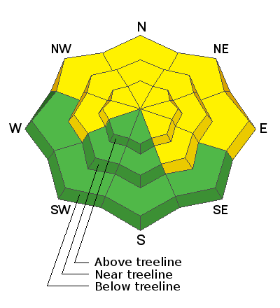
Low
Moderate
Considerable
High
Extreme
Learn how to read the forecast here
 Special Announcements
Avalanche Forecasters Toby Weed and Paige Pagnucco investigated a recent avalanche fatality in Idaho just north of the Utah border.
 Weather and Snow
It's going to be a beautiful day in the mountains. Breezy northerly winds that have blown for the past couple of days began to back off a little after midnight. They'll continue to decrease becoming mostly calm by mid-day. High temps at 10,000' will be near 30 degrees. High pressure will dominate the next few days with clear skies, mostly calm winds, and warming temps. On Thursday, an upper-level low will move through the 4 Corners and it's looking like it could give us a shot of snow. High-pressure returns for the extended period with a continued glimmer of hope for a change around mid-month.
Snow totals at Buckboard Flat (8924')
Snow totals at Camp Jackson (8858')
Snowpack Discussion
Warm temperatures and time have helped consolidate the snowpack, but weak layers are still present, especially in shady areas at higher elevations. A poor snowpack structure still exists and on slopes facing NW-N-SE a slab 1'-3' thick exists on top of buried, weak, facets. These slabs are becoming harder to trigger but once released they would produce deep and dangerous avalanches. Likely trigger points include shallower areas along slope margins, around sparse trees or rock outcroppings, or on repeat running slide paths.
Steep north-facing terrain is the most likely place you can still trigger a deep, persistent-slab avalanche. This is an aerial photo of a NW aspect of Jackson Ridge taken on 2/23/2021. You can see that snow depth is variable, and winds have drifted snow, creating dangerous slabs over buried weak layers.
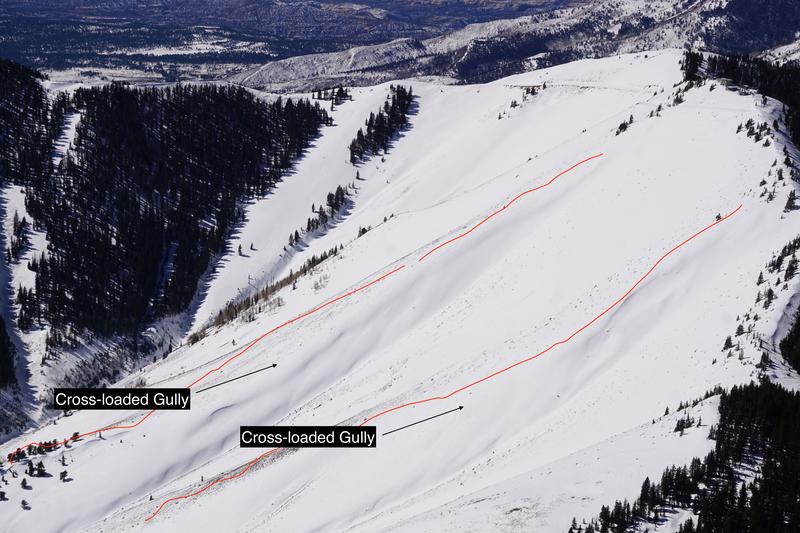
On SE aspects like this terrain on Abajo Peak, ridgelines are shallow, while more easterly aspects have been cross-loaded by winds over the last few weeks.
Additional Information
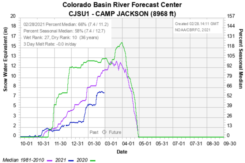
Here is where we are with the snowpack. Camp Jackson is at 66% of normal for this time of year.
Information on outdoor recreation - The State of Utah created this webpage with information about recreating on both state and federal public lands during the current health crisis.
New to the backcountry (including riding at closed resorts) - Watch the award-winning, 15 minute Know Before You Go video, or take the 5-part, free online-learning series.
General Announcements
This forecast is from the U.S. Forest Service, which is solely responsible for its content. This forecast describes general avalanche conditions and local variations always occur.