SAVE THE DATES!
Saturday, December 6 - 18th Annual Utah Snow and Avalanche Workshop (USAW). This session will be held in-person at the Wasatch Jr High School Auditorium. 3750 S 3100 E, Salt Lake City, UT 84109. Information and tickets are available here.
Avalanche Awareness Week!
The 7th Annual Avalanche Awareness is the first week of December! This week is jam-packed with events to get you ready for the season and a chance to connect with other backcountry users. We hope to see you out there!
Since winning in storm totals last week, the Ogden area received spits and spats which didn’t produce as much as the optimistic end of the totals promised. Across the Northern Wasatch, we saw a mix of rain and snow since, with final totals coming in at:
Ogden Skyline: Trace to .2 inches of H2O, mostly falling as rain
Mountains East of Eden: .2-.3" inches of H2O, with 1-3" of snow and rain
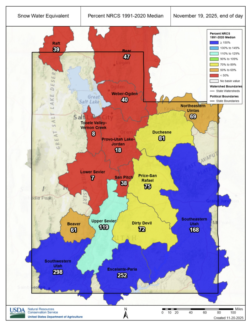
The high pressure ridge off the Pacific continues to split storm systems in unusual patterns toward Northern Utah. The Northern Wasatch mountains could see up to 1-3" of snow with a weak storm and a stark drop in temperatures arriving at the beginning of next week. The modest high elevation accumulations from this small system will be threatened by the rapidly rising temperatures later next week. As of Wednesday the 19th, the NRCS puts us at less than 50% of median SWE. There's promise of a stronger system spinning in from the NW at the end of the month with cold temperatures and more precipitation—though it's too early to be sure. Keep your fingers crossed.
Snow conditions remain pretty grim. The highest elevation, cold northerly slopes continue to be the only places potentially holding any snow. Yesterday's deluge took care of washing away some old rotting snow but not all of it. While there's not a whole ton of snow out there right now, keeping track of coverage leading into storm events will give you a keener eye of where you may find old snow at the base of the snowpack...once we have more of one.
Bo Torrey, Nikki Champion, and myself took a walk up to ridgeline along the N. Ogden Divide yesterday before the Ogden Area Pro Observer's meeting (thanks for coming out). We could barely see trace amount of coverage on northerly slopes on the S. Ogden Divide.
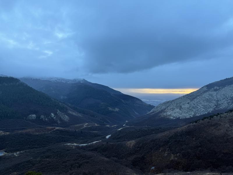
If you squint just right, you can see trace amounts of snow left on northerly terrain yesterday afternoon, viewed from the North Ogden Divide - Maushund/Torrey/Champion