Under clear skies, mountain temps are in the single digits to below zero and a cold NE wind is blowing. High temps today will creep up into the teens with continued breezy NE winds averaging 10-15 mph with gusts into the 20's along ridge tops. Conditions look to remain dry and clear through mid-week with models coming into a closer agreement over a low-pressure system moving through the 4 Corners on Thursday that may bring us a chance for a few inches of snow. A significant change is still being advertised for around the 11th.
Snowpack Discussion
Warm temperatures and time have helped consolidate the snowpack, but weak layers are still present, especially in shady areas at higher elevations. A poor snowpack structure still exists and on slopes facing NW-N-SE a slab 1'-3' thick exists on top of buried, weak, facets. These slabs are becoming harder to trigger but once released they would produce deep and dangerous avalanches. Likely trigger points include shallower areas along slope margins, around sparse trees or rock outcroppings, or on repeat running slide paths. It remains a gamble out there right now, and it's not a chance any of the forecasters or observers I know are willing to take.
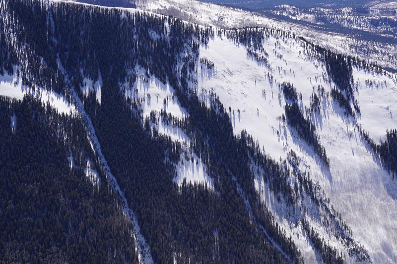
Steep north-facing terrain is the most likely place you can still trigger a deep, persistent-slab avalanche. This is an aerial photo of a NW aspect of Jackson Ridge taken on 2/23/2021. You can see that snow depth is variable, and winds have drifted snow, creating dangerous slabs over buried weak layers.
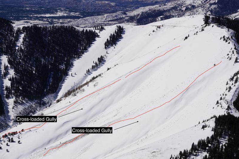
On SE aspects like this terrain on Abajo Peak, ridgelines are shallow, while more easterly aspects have been cross-loaded by winds over the last few weeks.