Forecast for the Skyline Area Mountains

Issued by Brett Kobernik on
Monday morning, November 17, 2025
Monday morning, November 17, 2025
We are slowly getting ready for the winter season of avalanche forecasting. There is currently no avalanche danger. Here's a quick weather and snow update.
Utah has been generally under a ridge of high pressure during the first half of November. The pattern has changed and now there are a series of low pressure troughs (storms) lined up. This is what we call an "active pattern". While it's active, these storms aren't completely lining up to favor lots of snow in our area. We'll see some periods of snow through the end of the month. Just how much is yet to be seen. The good thing is that the pattern is active and slight shifts in the storm directions could favor our area more.
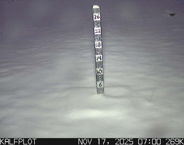
This recent storm that just moved through left 3 to 4 inches of new snow. It was a fairly warm storm with temperatures in the mid to upper 20s. The snow level only dropped to around 7000' with rain/sleet below that. It wasn't an excessively windy storm but there are some stronger speeds along the highest peaks this morning.
We may see some lingering snowfall today not really adding up much. The next chance for accumulations looks like Weds/Thurs of this week.
I'll be intermittently updating the forecasts as conditions warrant.


