Forecast for the Skyline Area Mountains

Brett Kobernik
Issued by Brett Kobernik on
Wednesday morning, December 23, 2020
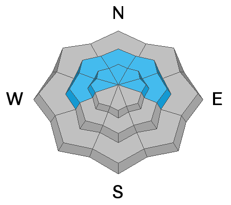
A CONSIDERABLE avalanche danger exists in mid and upper elevation more northerly facing terrain. Northerly facing steep slopes should not be trusted. The snow will get more stubborn and won't collapse (WHOOMP) underneath you as much as a few days ago but the weak snow near the ground is here to stay for a while. It will no doubt cause future avalanches.
Low
Moderate
Considerable
High
Extreme
Learn how to read the forecast here
Weather and Snow
Current Conditions: Temperatures plummeted yesterday afternoon dropping into the single digits overnight. It was windy on Tuesday and the wind is still up a bit from the west but showing signs of slowing. A trace to a couple of inches of snow fell.
Mountain Weather: Today, temperatures will warm into the teens. We may see the cloud cover break over the mountains although it looks like it could hang over the valleys all day. It looks like the wind will let up a bit this morning but may increase again this afternoon. Anticipate a little wind along the higher ridges today. A storm will move through this weekend but it looks like it's going to go to our north. The next real chance for snow is around the 29th.
Ad
Avalanche Problem #1
Persistent Weak Layer
Type
Location
Likelihood
Size
Description
We will be talking about the weak sugar snow near the ground at least through January, possibly longer depending on what the weather does for us. It's a dangerous situation. Below is a video from the always thoughtful Darce Trotter about his take on the snowpack;