Forecast for the Skyline Area Mountains

Brett Kobernik
Issued by Brett Kobernik on
Tuesday morning, December 22, 2020
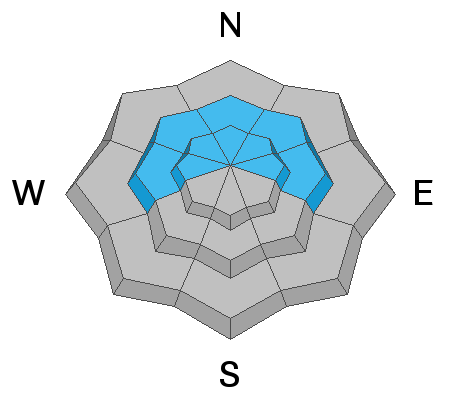
A CONSIDERABLE avalanche danger exists in mid and upper elevation more northerly facing terrain. Gusty wind today may form some fresh drifts of snow. This will increase the avalanche danger especially in areas where there is old weak snow near the ground present. Continue to avoid steep upper elevation northerly facing terrain.
Low
Moderate
Considerable
High
Extreme
Learn how to read the forecast here
Weather and Snow
Mountain Weather: Temperatures start out warm this morning in the 20s but will drop during the day into the single digits by this evening. It's going to get a bit windy today with gusts from the west. It'll be mostly cloudy also and we may see a little snow. I'm not expecting much if any snow accumulation. Not the most inspiring day to go into the mountains. The next chance for snow is this weekend when another small storm will move through.
Ad
Avalanche Problem #1
Persistent Weak Layer
Type
Location
Likelihood
Size
Description
A Persistent Weak Layer of faceted (sugary) snow near the ground will continue to be our main avalanche concern for the foreseeable future. This old snow from November will fail and collapse under the newer snow from December. It will get less sensitive but it's going to remain in place and be an issue for the next storms. This situation is nothing to screw around with.