Forecast for the Abajos Area Mountains

Eric Trenbeath
Issued by Eric Trenbeath on
Thursday morning, January 9, 2020
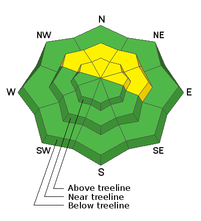
Though the odds of triggering an avalanche are decreasing, the danger remains MODERATE. Human triggered avalanches are possible on steep, wind drifted slopes primarily at upper elevations on slopes facing NW-N-E. A triggered wind slab also has the potential to step down into a buried, persistent weak layer causing a deeper and more dangerous avalanche. You are most likely to encounter a persistent weak layer on steep, shady, northerly facing slopes. Most low elevation and south-facing terrain have LOW danger.
Low
Moderate
Considerable
High
Extreme
Learn how to read the forecast here
Special Announcements
Grooming: The Hart's Draw road has been recently groomed to 70's Flat.
Weather and Snow
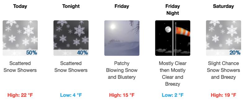
An upper-level trough on a SW flow will dive across the Great Basin and into the 4 Corners region later this afternoon. Today look for mostly skies with scattered showers developing later in the day. 1"-3" are possible by tomorrow. SW winds will average 15-20 mph along ridge tops and high temps will be in the low 20's. A dry northwesterly flow follows on Friday. Long term looks active and unsettled though it doesn't look like a lot of snow for us at this time. Let's hope that changes!
Snow totals at Buckboard Flat (8924')
Snow totals at Camp Jackson (8858')
Wind, temperature, and humidity on Abajo Peak (11,000')
Recent Avalanches
General Announcements
This forecast is from the U.S. Forest Service, which is solely responsible for its content. This forecast describes general avalanche conditions and local variations always occur.