Join us at our 2nd Annual Blizzard Ball

Forecast for the Uintas Area Mountains

Andrew Nassetta
Issued by Andrew Nassetta on
Sunday morning, December 15, 2024
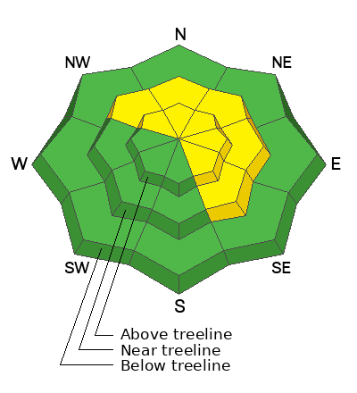
Today’s avalanche danger is MODERATE at mid and upper elevation terrain. Human-triggered avalanches are POSSIBLE on steep slopes facing northwest through southeast where wind drifted old and new snow sit atop faceted, weak snow.
I expect you could trigger today’s avalanches remotely, from a distance, or on slope. For good riding and reduced risk to the avalanche hazard I’m dialing back my slope angles to less than 30 degrees and finding protected terrain on the north half of the compass without any overhead hazard or steep slopes above me.
Low
Moderate
Considerable
High
Extreme
Learn how to read the forecast here
Special Avalanche Bulletin
What: Heavy snowfall and drifting by strong winds will cause dangerous avalanche conditions to develop this weekend in the mountains of northern Utah.
When: In effect from 6 am MST this morning through 6 am Monday morning
Where: For the mountains of Northern Utah and Southeastern Idaho, including the Wasatch Range...Bear River Range... and Western Uinta Mountains.
Impacts: Dangerous avalanche conditions will develop on many slopes today. People are likely to trigger avalanches by being on or below slopes steeper than 30 degrees. Avalanches could be triggered remotely (from a distance) or from below. What to do: Avoid traveling on or underneath steep north-facing terrain at mid and upper elevations in the backcountry. Carry and know how to use avalanche rescue equipment.
Special Announcements
Gear up for the season or score great deals on gifts for loved ones this holiday season while supporting the UAC’s efforts. Your participation directly funds the state's avalanche forecasting, awareness, and education programs. Check out the auction found here!
Weather and Snow
Nowcast
Since 0500 AM yesterday, snow totals range from a trace to a couple inches across the range, while the Mirror Lake Corridor and North Slope did a bit better, recording 4” of snow with .4” of SWE. Steady south and southwest winds average 40 MPH on the exposed ridges with gusts into the 60’s near the high peaks and helping to reshape the snowscape and lay of the land overnight. Temperatures hover in the teens at 10,000’ with windchill in the negatives.
Forecast
For today, look for periods of stormy weather with the potential for up to 4” of additional snowfall. Expect winds to continue from the west averaging 20 MPH with cold gusts into the 30’s. Temperatures will stick in the teens today, but it’ll feel pretty rugged with windchill near the ridges. A brief period of clearing this afternoon should provide broken skies and improved visibility.
Futurecast
A lull in the action is slated for tonight into early Monday, but the pattern stays active with the potential for additional snowfall creeping back in Monday night into Tuesday. Not a big storm, maybe just a quick refresh. Sunshine and mild temps will help close out the work week heading into Saturday.
Snowpack & Travel
I was out the past few days on the hill as the storm came to fruition, and got a pretty good fix on our current set-up. My main focus is the new snow and wind building a slab on top of, and loading the old, weak, faceted snow. In many areas, the slabs present as wind drifts sitting on top of the old snow. In more protected areas out of the wind zone we have plenty of weak snow, but no blow to help form the slab.
Recent Avalanches
Yesterday, Ted noted small new snow avalanches failing on the extremely weak old snow/new snow interface. More information on avalanches and current conditions from the range are found here.
Ad
Avalanche Problem #1
Wind Drifted Snow
Type
Location
Likelihood
Size
Description
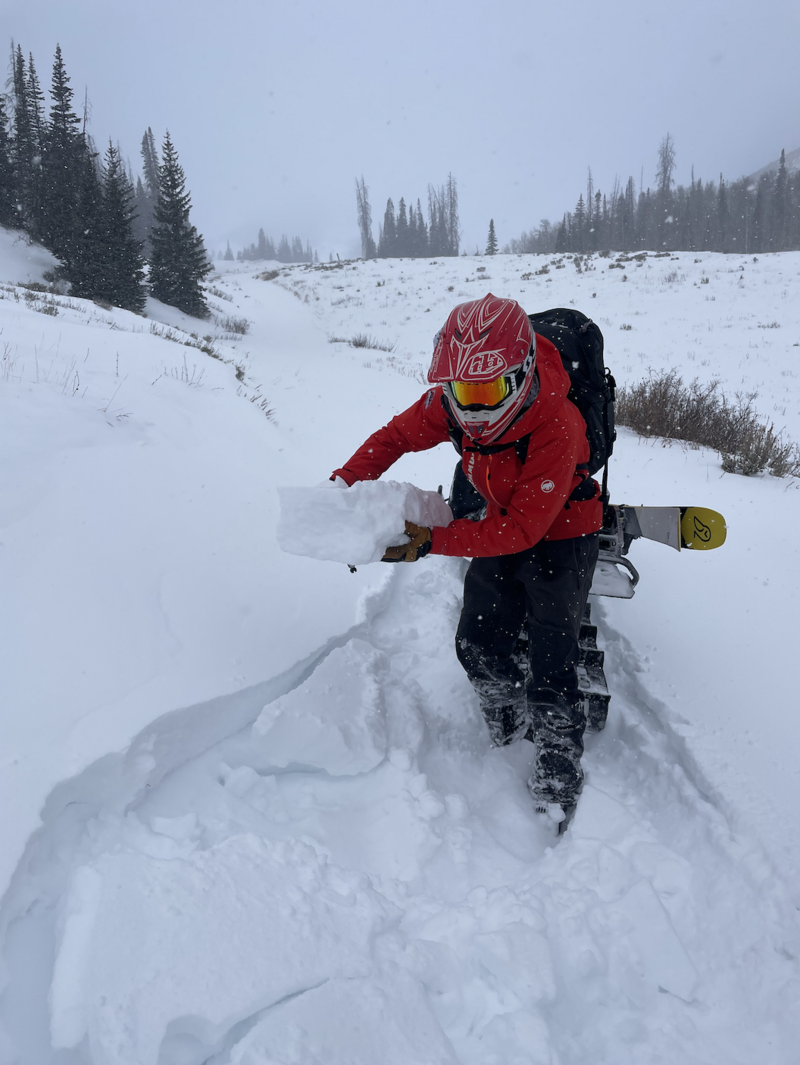
Over in Trout Creek Friday, I observed fresh drifts that were sensitive to the weight of my ride. The drifts have only grown in size and become more sensitive, since then.
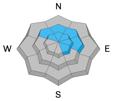
Since yesterday morning, recent snow and steady winds have loaded many steep, leeward slopes at mid and upper elevations on the north half of the compass. Things are getting real out there and today's avalanches could break deeper and wider than we might expect and are big enough to injure, bury or kill us. Any avalanche right now could prove traumatic, and will be enhanced by a nasty ride through rocks, stumps and other terrain features will increase the consequences if caught.
I'm keeping my distance from the wind zone and finding protected, low angle, north facing terrain where the riding is good and the hazard is reduced, or non-existent.
Avalanche Problem #2
Persistent Weak Layer
Type
Location
Likelihood
Size
Description
Our snowpit from Trout Creek Friday shows an abundance of weak snow and a slight slab on top of old snow that proved reactive in our snow stability tests.
A majority of the snowpack has grown weak and sugary forming our PWL (persistent weak layer). We are not seeing recent avalanches on this layer, but new snow and wind have come together to bring things to life.
We have the ability to trigger today's persistent slab avalanches as a rider from the bottom of a slope, at a distance, or even on an adjacent slope. Avoidance is key with this avalanche problem as we continue to build a slab on our existing snowpack structure and this problem persists.
General Announcements
Additional Information
The Uinta weather station network was upgraded this summer and all that real-time info is found here. Simply click on the "Western Uinta" tab and then the "Weather Stations" tab to find all your weather needs.
We are always looking for snow and avalanche observations or just general riding conditions. So... if you see something, say something. You can reach our team directly by contacting: Craig at craig@utahavalanchecenter.org, 801-231-2170, or Andrew at andy@utahavalanchecenter.org, or 860-460-8142.
General Information
This forecast is from the U.S.D.A. Forest Service, which is solely responsible for its content. This forecast describes general avalanche conditions and local variations always occur. This forecast was issued on Sunday, December 15th at 06:00 AM and expires 24 hours after it was issued. We will update the forecast by 0700 AM tomorrow. But, in the meantime reach out to us with questions, or if you see anything in your travels.