Join us at our 2nd Annual Blizzard Ball

Forecast for the Uintas Area Mountains

Andrew Nassetta
Issued by Andrew Nassetta on
Monday morning, December 16, 2024
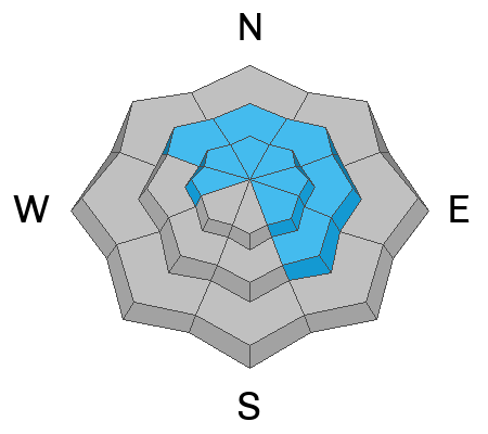
In mid and upper elevation terrain the avalanche danger is MODERATE. Human triggered avalanches breaking up to 3’ deep are POSSIBLE, especially on steep, wind drifted slopes facing west through southeast.
Heads up… it’s tricky out there because we can trigger today’s avalanches remotely, meaning from a distance, we don’t even have to be on the slope. My exit strategy is to dial back my slope angles to less than 30 degrees and search out wind sheltered terrain on the north half of the compass without any overhead hazard, or steep slopes above me.
Low
Moderate
Considerable
High
Extreme
Learn how to read the forecast here
Special Announcements
Today is the final day to gear-up for the season or score great deals on gifts for loved ones this holiday season while supporting the UAC’s efforts. Your participation directly funds the state's avalanche forecasting, awareness, and education programs. Check out the auction found here!
Weather and Snow
Nowcast
Since yesterday morning, snow totals are showing 1-3" with a whopping .3 SWE...meaning, super low density. We have had over 48 hours of steady wind from the southwest averaging 30 MPH, blasting into the 50’s near the high peaks, nearly knocking me off my sled and reshaping the snowscape. Temperatures are cool at 10℉ near our highest peaks and closer to 20℉ at the trailheads.
Forecast
For today, expect broken skies, scattered afternoon snow showers and mild temps as a weak system passes to our north. Meanwhile, south and southwest winds taper off this morning, only to ramp back into the 30’s by late afternoon. Temperatures will warm and feel mild at trailheads, climbing into the low 30’s but more winter-like with elevation gain near the ridgelines.
Futurecast
Expect another inch or two of snow overnight into Tuesday, followed by sunshine and fair weather for the remainder of the work week. Our next significant shot of precipitation should be on tap for early next week.
Recent Avalanches
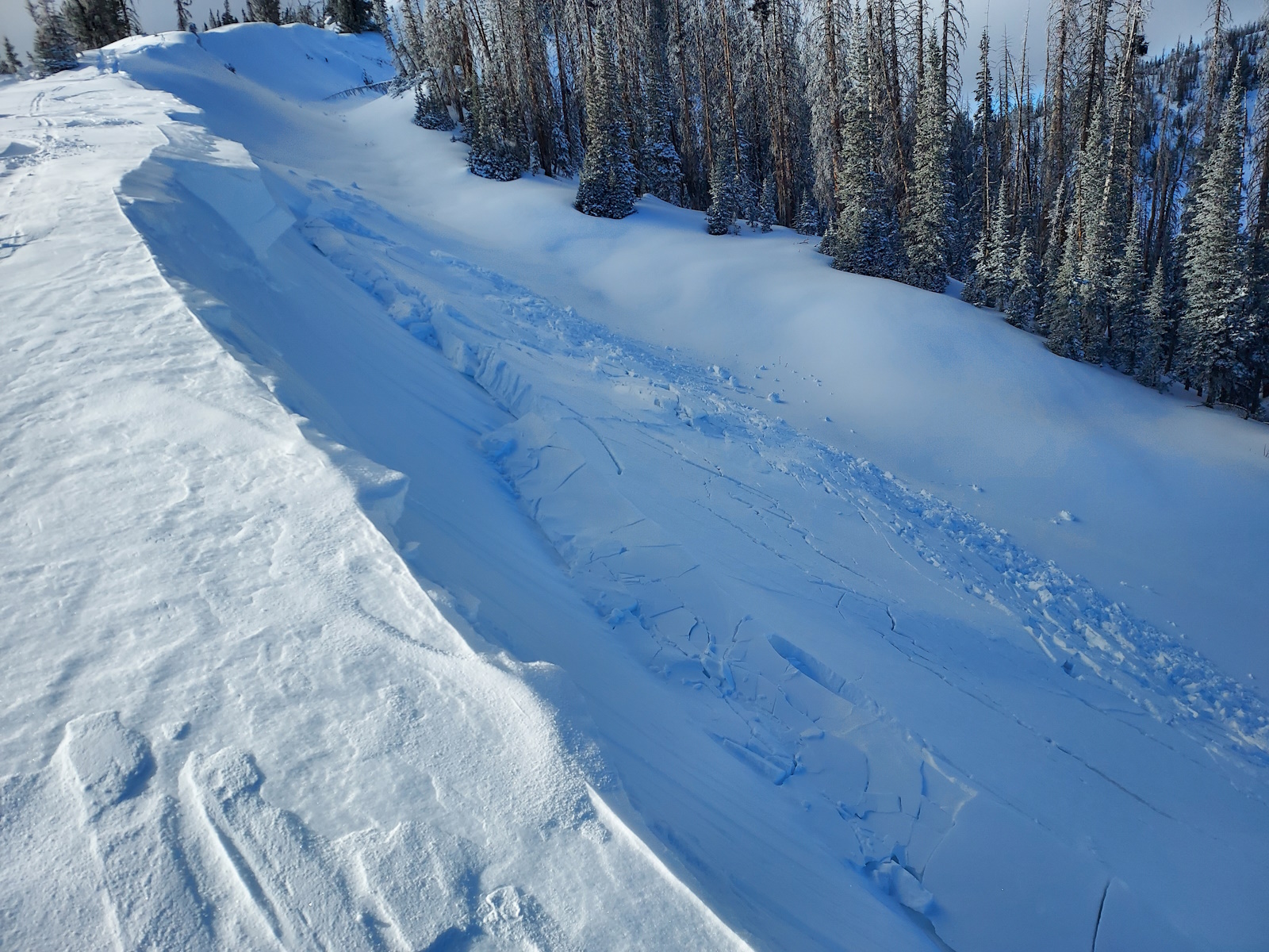
Michael J was in the Hoyt peak hood yesterday and remotely triggered small, yet hard wind drifts, resting on weak, old, faceted snow. These avalanches were specific to steep slopes, in the wind zone, and fit the characteristics of today's avalanche hazard.
See more from Michael and across the range, here -- Thanks for the great photos!
Ad
Avalanche Problem #1
Wind Drifted Snow
Type
Location
Likelihood
Size
Description
Steady winds from the south loaded steep, leeward slopes facing northwest through the southeast. Today's wind drifts will be stiff, up to 3' deep, and can be triggered from a distance. Once triggered, the consequences of taking a ride or becoming caught and carried will only increase due to our shallow snowpack and the presence of rocks, stumps, and other terrain hazards.
Look for recent avalanches, cracking and collapsing, as well as rounded pillows where the slope looks "fat". Im avoiding drifted areas in the wind zone today and seeking sheltered terrain where coverage and riding are best and the hazard is low.
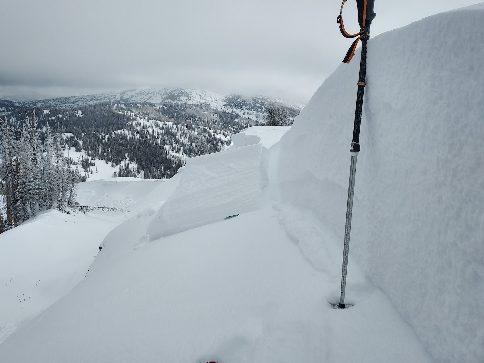
A northwest facing slope at 9,700' on Hoyt Peak where a stiff wind drift was triggered.
Avalanche Problem #2
Persistent Weak Layer
Type
Location
Likelihood
Size
Description
The snowpack is showing more and more signs of poor structure that can produce persistent slab avalanches. In areas facing west through southeast at mid and upper elevations, it’s possible to trigger a slab on our weak PWL that could break deeper and wider than we might expect. Break out your shovel, and do a little digging to observe this obivous and poor snowpack structure.
We have the ability to trigger today's persistent slab avalanches as a rider from the bottom of a slope, at a distance, or even on an adjacent slope. Avoidance of this avalanche terrain is key as we continue to build a slab on our existing snowpack structure and this problem persists.
General Announcements
Additional Information
The Uinta weather station network was upgraded this summer and all that real-time info is found here. Simply click on the "Western Uinta" tab and then the "Weather Stations" tab to find all your weather needs.
We are always looking for snow and avalanche observations or just general riding conditions. So... if you see something, say something. You can reach our team directly by contacting: Craig at craig@utahavalanchecenter.org, 801-231-2170, or Andrew at andy@utahavalanchecenter.org, or 860-460-8142.
General Information
This forecast is from the U.S.D.A. Forest Service, which is solely responsible for its content. This forecast describes general avalanche conditions and local variations always occur. This forecast was issued on Monday, December 16th at 06:00 AM and expires 24 hours after it was issued. We will update the forecast by 0700 AM tomorrow. But, in the meantime reach out to us with questions, or if you see anything in your travels.