Current Conditions: Windy conditions continued on Monday with moderate to strong speeds. The direction switched to the southwest which I either overlooked or didn't anticipate in yesterday's forecast. Regardless, the sustained wind from the last 5 days looks like it has slowed. Temperatures were warm on Monday with many locations at freezing or a bit higher. Riding conditions are hit or miss but I will say I had an enjoyable day riding my machine around Monday while doing fieldwork. I think what made it for me is that we are finally able to cautiously travel around to more places. The snowpack is starting to become supportable. That said, there are still lots of places where it is not supportable and you punch right through to the ground.
Mountain Weather: We'll see cloudy skies today with high temperatures in the upper 20s and moderate speed west southwest wind. A small storm rolls through later today and tonight that might be good for a few inches of snow. Weather models continue to hint at wet weather ahead with a better looking storm for around Friday. We'll see.
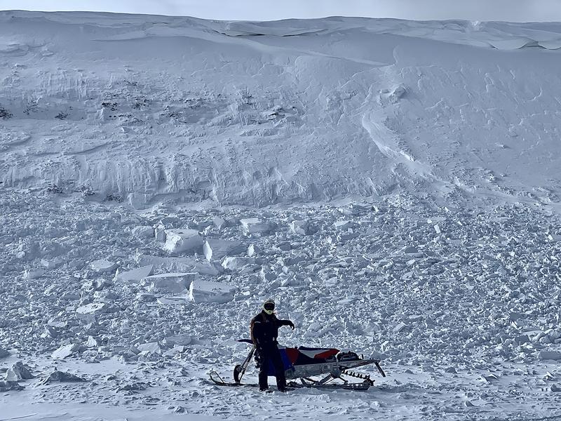
On Monday I rode around the upper reaches of Manti Canyon and found numerous sled triggered avalanches from the weekend. At least one caught and carried a rider. I'll have details tomorrow after I get done compiling the reports.
Below: Jet Fox Reservoir - most likely a natural release from northwest wind drifting and loading snow onto the slope. However, there are nearby snowmobile tracks so it is certainly possible that this was remotely triggered by them.