Current Conditions: The strong northwest wind continued over the last 24 hours forming drifts and crusts in various locations. It got down into the bottoms of the canyons and drainages and even stirred things up in there. It has showed signs of slowing from its max speeds. Temperatures remain fairly mild with overnight readings in the upper 20s. Riding conditions remain variable with some places being supportable for skis and machines and some places punchy.
Mountain Weather: Wind will continue today although I'm not expecting it to be quite as strong as Sunday. Temperatures will be a bit warmer today with highs around 30 or a bit more. We'll see a few more clouds than on Sunday. A storm moves through on Tuesday which should produce 2 to 4 inches of snow. Temperatures cool off as the week progresses with quite cold weather anticipated by Saturday. Weather models indicate a period of wet weather ahead but being that they've been so fickle for the last few months I am not paying much attention to more than a few days ahead.
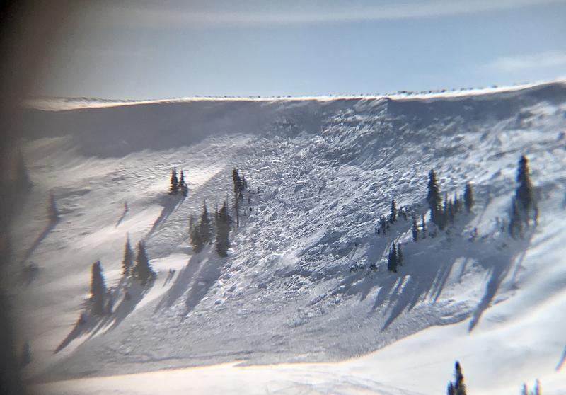
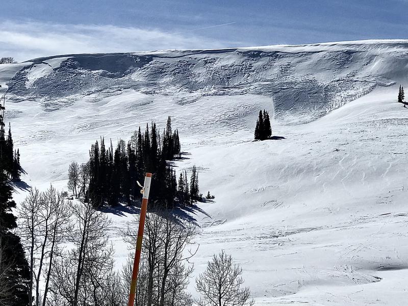
A couple of decent size natural avalanches occurred within the last 48 hours. One in upper Spring Creek south of the kiting lot and one on the notorious Wedding Ring Ridge.
SPRING CANYON REPORT and
WEDDING RING REPORTBelow: Spring Creek
Below: Wedding Ring Ridge