Ski-Doo produced a new avalanche awareness video that forecasters at the UAC helped out with. It highlights the importance of getting avalanche educated if you plan to ride in the mountains. On a related note,
Big Pine Sports has picked up the Ski-Doo line and they are now an official dealer. Congrats Jared, this is a great resource for the snowmobile community.
Current Conditions: Monday felt like a spring day with mild temperatures, plenty of sun and light wind. East, south and west facing slopes became damp from the sun. They'll have crusts this morning. North facing slopes stayed dry and decent settled powder is still around. Temperatures were in the mid to upper 20s overnight and the west wind increased in speed over the highest peaks.
Mountain Weather: It'll be another gorgeous spring-like day in the mountains with mild temperatures and light to moderate west wind in most places. It's going to feel a little breezy along the highest terrain. We'll probably see a few more clouds streaming through compared to Monday. The next chance for snow is late Wednesday which won't produce much. Unsettled weather for the weekend looks like it might bring a decent snow refresher.
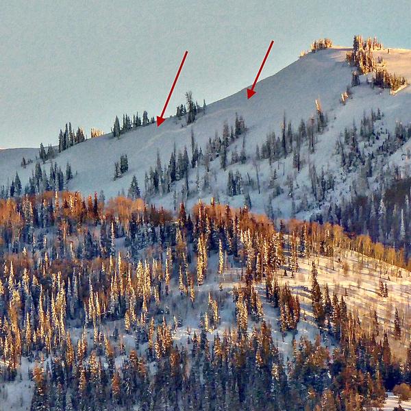
I continue to find more natural avalanches as I look around the mountains. I spotted this one (photo below) from the valley north of Mt Pleasant. It was in the South Fork of Coal Fork. Judging by the crisp fracture line, it probably ran early Sunday with the spike in wind speeds. It's possible it ran during the natural cycle last Wednesday. I've recorded 38 avalanches over the last couple of weeks. This started after we added a significant enough slab of snow on top of our early season weak layers.
COMPLETE SKYLINE AVALANCHE LIST HERE