Ski-Doo produced a new avalanche awareness video that forecasters at the UAC helped out with. It highlights the importance of getting avalanche educated if you plan to ride in the mountains. On a related note,
Big Pine Sports has picked up the Ski-Doo line and they are now an official dealer. Congrats Jared, this is a great resource for the snowmobile community.
Current Conditions: The strong west wind really did a number on the snow in many high locations on Sunday. It was cold also. Overnight temperatures were in the mid teens and the west wind has slowed in many locations. Despite the wind drifting snow, you'll still find plenty of nice powder to ride.
Mountain Weather: We have a couple of days of mild weather ahead. Today will be mostly sunny with highs into the upper 20s along the ridges. Westerly wind should continue to slow during the day. I'm not seeing any significant storms on the horizon. It looks like there are a few smaller ones that might produce a few inches here and there. Hopefully enough to keep riding conditions decent. The next chance for snow looks like it'll be Wednesday night.
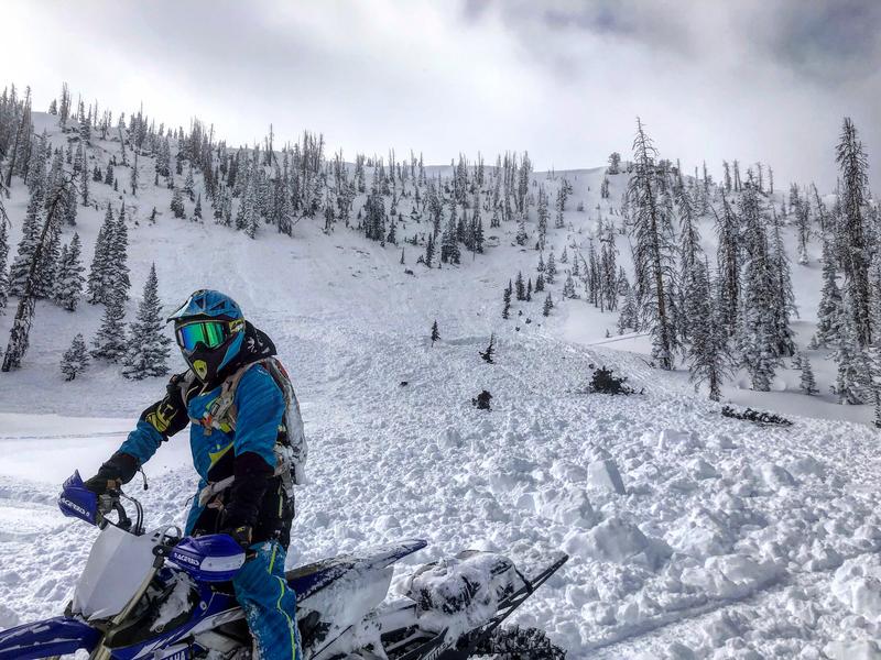
There was a massive snowbike triggered avalanche on Sunday. A group of riders were well aware of avalanche conditions and were purposely avoiding steep slopes. They traveled through a meadow and regrouped. When they turned around, their stomachs dropped at the sight of a large avalanche that had overrun their tracks. They had triggered it from the flats and it released hundreds of feet above them. This could have easily been a fatal avalanche.
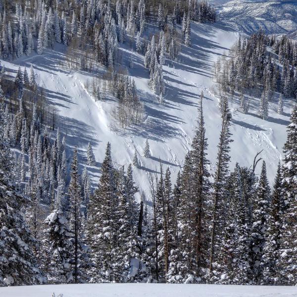
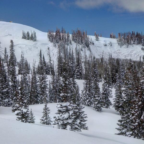
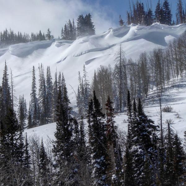
During my travels through Ephraim and Manti canyons I came across numerous other recent avalanches. All of these are failing on the weak faceted snow at the base of the snowpack. I'll have reports completed today. Here are a few highlights:
Below: Natural trigger, lower Jimmys fork
Below: Snowmobile remotely triggered, Middle Fork, Manti Canyon
Below: Natural trigger, The Cove, Ferron Canyon.