Current Conditions: Saturday's small storm didn't add much snow in most areas. However, it does appear that areas in the central portion of the Skyline (Pleasant Creek to the Horseshoes) picked up about 4 inches. There was some stronger wind involved overnight that was drifting snow. Temperatures dropped down to around 10˚F overnight.
Mountain Weather: The stronger northwest wind should slow a bit during the day. It'll be moderately breezy still along the higher terrain. Cloud cover is going to be a little bit tricky. There may be enough low level moisture to support clouds socked into the mountains all day. On the other hand, it's possible things may clear up. It is going to remain fairly cold today with highs only in the low teens.
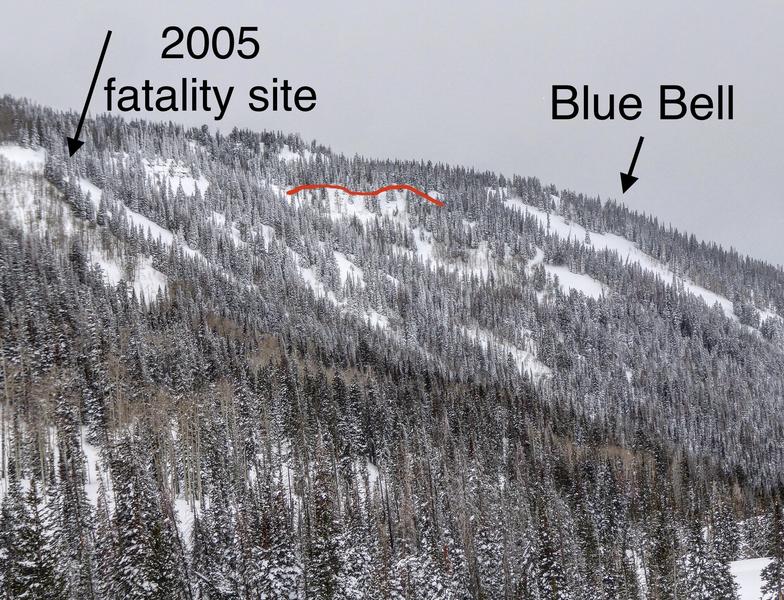
I documented some more recent avalanches after traveling around in Ephraim Canyon on Saturday. These all appeared to have released naturally most likely on Wednesday.
Photos below: Just east of the old Blue Bell ski hill.
Photo below: South facing path that came across the road. This was just before the short cut turn off through the gully to Scotties. This one is notable because it is south facing and appears to have broken into the sugary facets at the base of the snowpack. I've been more concerned about south facing slopes this season compared to an average season and this confirms some of my thinking. NOTE - there are a handful of larger slopes that are similar to this that threaten the road. Depending on future weather events, it is possible that we may see more of these southerly facing slopes release and hit the road.
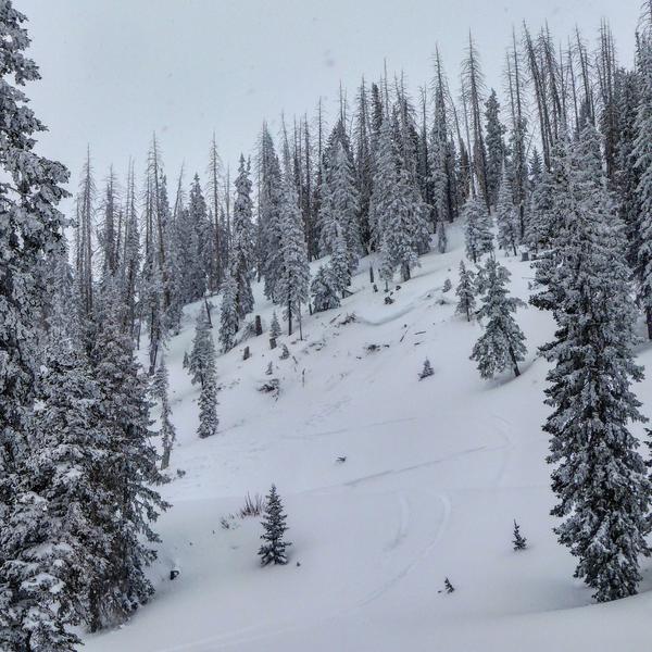
Photo below: A steep slope released above the road just up from Scotties. This area is somewhat of a usual suspect.
Photo below: Philadelphia Flats. This is the first little steep hill that you come to after climbing up from the main road. This is popular with many snowmobilers to hit and climb or high mark.