Current Conditions: Clouds lingered over the mountains on Thursday but overall it was a really nice day with good riding conditions. The new snow is very deep. There are still places that are unsupportable to machines where your track or skis punch through to the underlying sugary snow. All this makes travel still a bit difficult. Overnight temperatures were in the upper teens. Southwesterly wind has been increasing in speed over the last few hours.
Mountain Weather: Stronger westerly wind today along the ridgetops is the headline. It won't be real strong but it'll be a bit blustery. We'll see highs into the mid 20s. There's a chance for light snow mid day with no significant accumulation. Another impulse will move through on Saturday with some accumulation possible. Currently, I'm thinking we'll pick up 4 to 7 inches by Sunday.
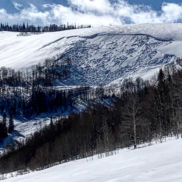
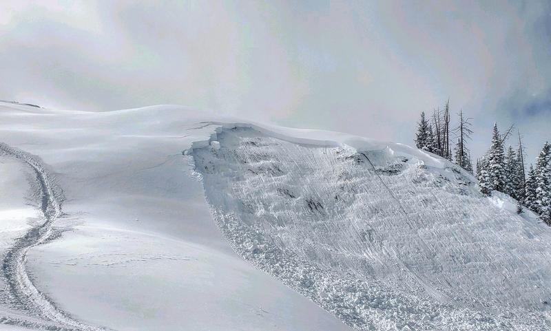
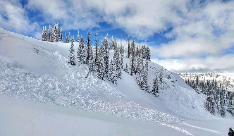
A number of avalanches were observed and reported on Thursday.
The most significant was a large natural avalanche that most likely released on Wednesday. It was just west of Miller Flat Reservoir. The fracture line is at least 6 feet deep. The debris ran across the Joe's Valley road and made it to the reservoir.
DETAILS HERE.
Photo: Larry Johansen
Some snowmobilers in Lowry Fork of Manti Canyon triggered a couple of deep but not all that large avalanches. These are certainly big enough to bury and kill a person though.
DETAILS HEREPhotos: Brian Seeley