Forecast for the Skyline Area Mountains

Brett Kobernik
Issued by Brett Kobernik on
Thursday morning, February 18, 2021
HIGH AVALANCHE DANGER TODAY!!
Human triggered avalanches are almost certain.
AVOID BEING ON OR BELOW ANY STEEP SLOPE.
PLACES YOU USUALLY TRAVEL MAY NOT BE SAFE TODAY!
Low
Moderate
Considerable
High
Extreme
Learn how to read the forecast here
Special Avalanche Bulletin
Conditions are perfect for avalanche accidents. Heavy snowfall and drifting from strong winds have overloaded an exceptionally weak snowpack leading to extremely dangerous avalanche conditions.
All the fresh Utah powder will likely lure people into dangerous avalanche terrain, and people are likely to trigger deadly avalanches. A brief break in the weather will allow the avalanche danger to drop slightly; however, people can still trigger large and deadly avalanches if they venture onto steep slopes.
  • Avalanches triggered by people could be extremely large, very dangerous, unexpected, and deadly.
  • The Utah Avalanche Center recommends people avoid travel on or underneath slopes steeper than about 30 degrees in the backcountry for the next several days.
  • Even if you are experienced and have the proper avalanche safety equipment, you should still avoid all steep slopes in the backcountry.
Weather and Snow
Current Conditions: The storm finally ended last night. We picked up another 3 to 6 inches in the last 24 hours. Totals are pushing 4 feet since last Friday. We basically doubled our snowpack. Temperatures dipped into the single digits and the northwest wind continues to gradually slow down.
Mountain Weather: We have a really nice day on tap with plenty of sun, light to moderate northwest wind and highs in the teens. It looks like we have two more chances for snow coming. One on Friday, one Saturday. These don't look huge but might produce a total of around 4 or 5 inches of new snow by Sunday.
Recent Avalanches
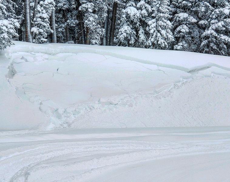
It appears we've gone through some sort of natural avalanche cycle early yesterday. Visibility has been poor so we haven't been able to confirm how much avalanche activity has gone on but we did get some hints on Wednesday. John Pikus stumbled onto this natural avalanche in a very odd location.
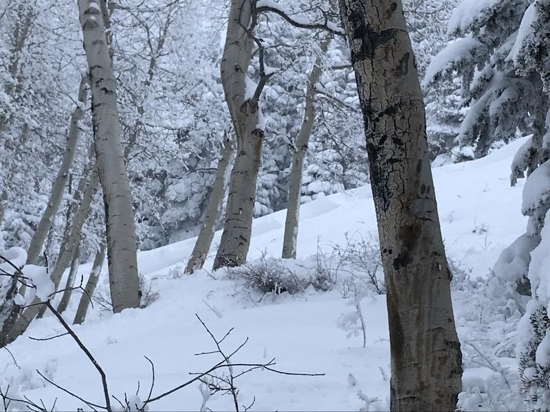
 DETAILS HERE
My partner and I saw what we thought were wide fracture lines in upper Spring Creek.
Snowmobilers triggered a handful of small but deep pockets along the Ephraim Canyon road on Wednesday. Photo below: Brian Seeley
Ad
Avalanche Problem #1
Persistent Weak Layer
Type
Location
Likelihood
Size
Description
The small amount of activity that was reported on Wednesday is enough to confirm how dangerous things are. Here are the red flags:
  • Natural avalanches, some breaking in odd locations that we usually don't see.
  • Snowmobile triggered avalanches, easily triggered, breaking into old weak sugary faceted snow.
  • Collapsing. I experienced a giant WHOOMP when I was doing snow measurements in a flat snow study plot area.
  • Poor snowpack structure. The pack contains a weak foundation of loose sugary snow.
  • Recent heavy snowfall. We've doubled our snowpack, stacking it up on the weak foundation.
  • Strong wind. There were periods during the storm where the wind was drifting a lot of snow.
It's all there. This should be very "in your face". The evidence is overwhelming. DON'T GO ON OR BELOW ANY STEEP SLOPE!!