Forecast for the Skyline Area Mountains

Brett Kobernik
Issued by Brett Kobernik on
Monday morning, February 17, 2025
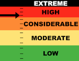
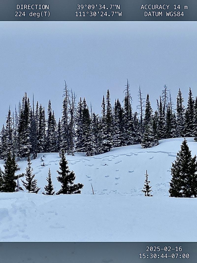
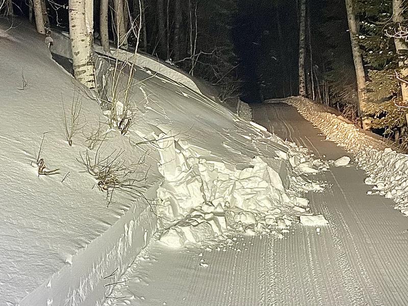
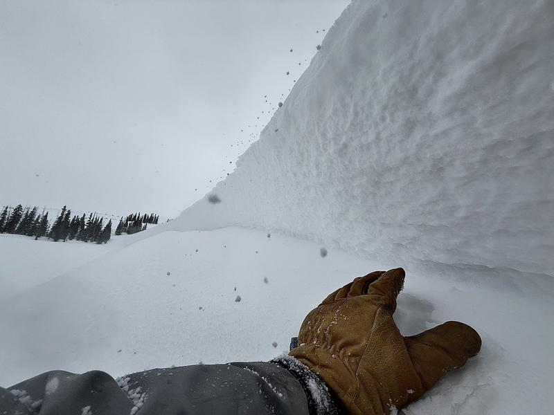
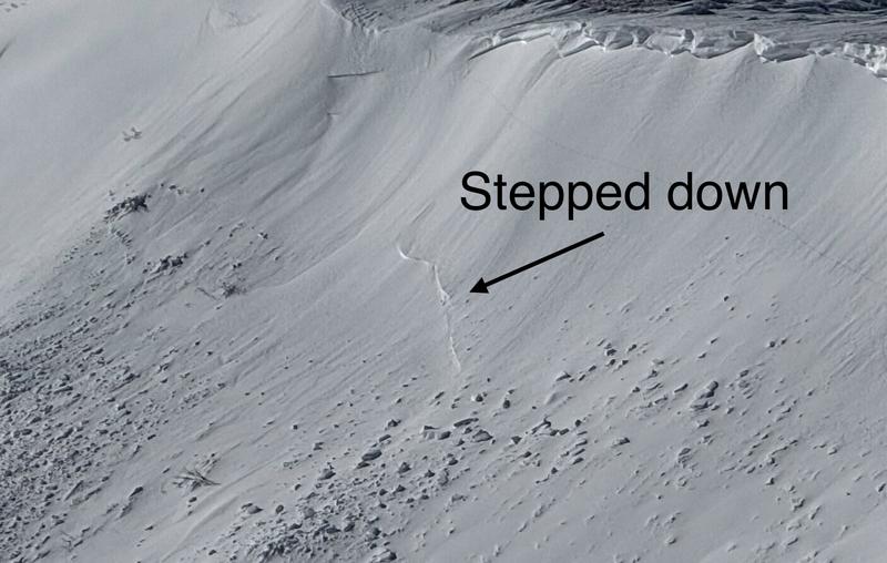
The avalanche danger on the Skyline is HIGH today.
Avalanches are breaking both within the newer snow as well as deeper into loose sugary facets.
Natural avalanches are not expected but human triggered avalanches are very likely.
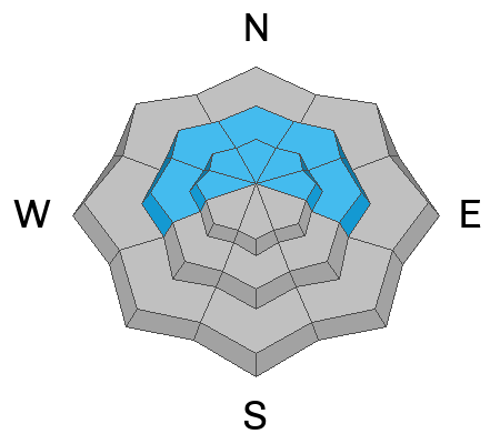
Continue to avoid all steep wind loaded slopes, especially those slopes facing northeast, east and southeast.
Low
Moderate
Considerable
High
Extreme
Learn how to read the forecast here
Weather and Snow
Current Conditions: The Skyline picked up a couple of inches of snow since Sunday. The wind from the west did not get nearly as strong as I anticipated but strong enough to transport snow. Temperatures reached around 30˚F Sunday and cooled into the mid 20s overnight. Riding conditions are slowly getting better but it's still kind of "hit or miss". More current condition info can be found in these two backcountry observations:
Mountain Weather: We're going to see mostly cloudy skies today with the chance of snow. Another impulse moves through later on and into Tuesday that could bring 2 to 4 inches of new snow. Wind will remain from the west in the moderate speed category. Temperatures will get up around 30˚F again. There's another system that will move through on Thursday bringing another chance for a few inches of new snow.
Recent Avalanches
There's been lot's of avalanche activity to report. There were natural avalanches during the storm and human triggered avalanches on Sunday.
Snowmobilers triggered a sizeable pocket in Six Mile Canyon. This one did not break deep into facets. No one was caught.
Photo: Dave Defriez
Snowcat grooming on N Skyline triggered a small but deep pocket. This one failed in old facets.
Photo: Larry Johanson
Ad
Avalanche Problem #1
Wind Drifted Snow
Type
Location
Likelihood
Size
Description
Two distinct avalanche patterns emerged from all the activity reported Sunday. The first involves newer wind drifted snow. There is a weakness just above the stout melt-freeze crust from the February warm up. Avalanches are breaking 1 to 2 feet deep. Most of the activity has been on more east facing slopes but I did spot one slide that ran on a south facing slope.
Photo: Fracture line of an east facing avalanche in Ephraim Canyon, Kobernik
.
Avalanche Problem #2
Persistent Weak Layer
Type
Location
Likelihood
Size
Description
The other pattern is avalanches breaking deeper into older sugary faceted snow. These are not as likely but the consequences are more severe. Again, east facing terrain is more dangerous because those slopes have been wind loaded. However, the facets are everywhere and all steep slopes should be avoided.
Photo: East facing avalanche in Rolfson Canyon that initially broke within the newer snow but stepped down into facets as it ran, Kobernik
General Announcements
This forecast is from the U.S.D.A. Forest Service, which is solely responsible for its content. This forecast describes general avalanche conditions and local variations always occur.