Forecast for the Skyline Area Mountains

Brett Kobernik
Issued by Brett Kobernik on
Saturday morning, February 13, 2021
INCREASING AVALANCHE DANGER TODAY!!
The avalanche danger is CONSIDERABLE and may rise to HIGH DANGER later today if the storm actually produces.
The snowpack is currently very dangerous and it is on the verge of having the doors come off the hinges. Continue to avoid being on or below any steep slopes. It is your only defense for staying safe right now.
Low
Moderate
Considerable
High
Extreme
Learn how to read the forecast here
Avalanche Watch
DANGEROUS AVALANCHE CONDITIONS ARE EXPECTED THROUGH THE WEEKEND.
THE WATCH IS FOR ELEVATED AVALANCHE DANGER IN THE BACKCOUNTRY BEGINNING SATURDAY MORNING AND LASTING THROUGH THE HOLIDAY WEEKEND
FOR ALL THE MOUNTAINS OF NORTHERN UTAH INCLUDING THE WASATCH RANGE...BEAR RIVER RANGE...UINTA MOUNTAINS...MANTI SKYLINE
HEAVY SNOW WILL CREATE WIDESPREAD AREAS OF UNSTABLE SNOW. BOTH HUMAN TRIGGERED AND NATURAL AVALANCHES WILL BECOME LIKELY. STAY OFF OF AND OUT FROM UNDER SLOPES STEEPER THAN 30 DEGREES.
Special Announcements
FREE BEACON TRAINING TODAY!!
When: Saturday, Feb 13, 9am to 1pm
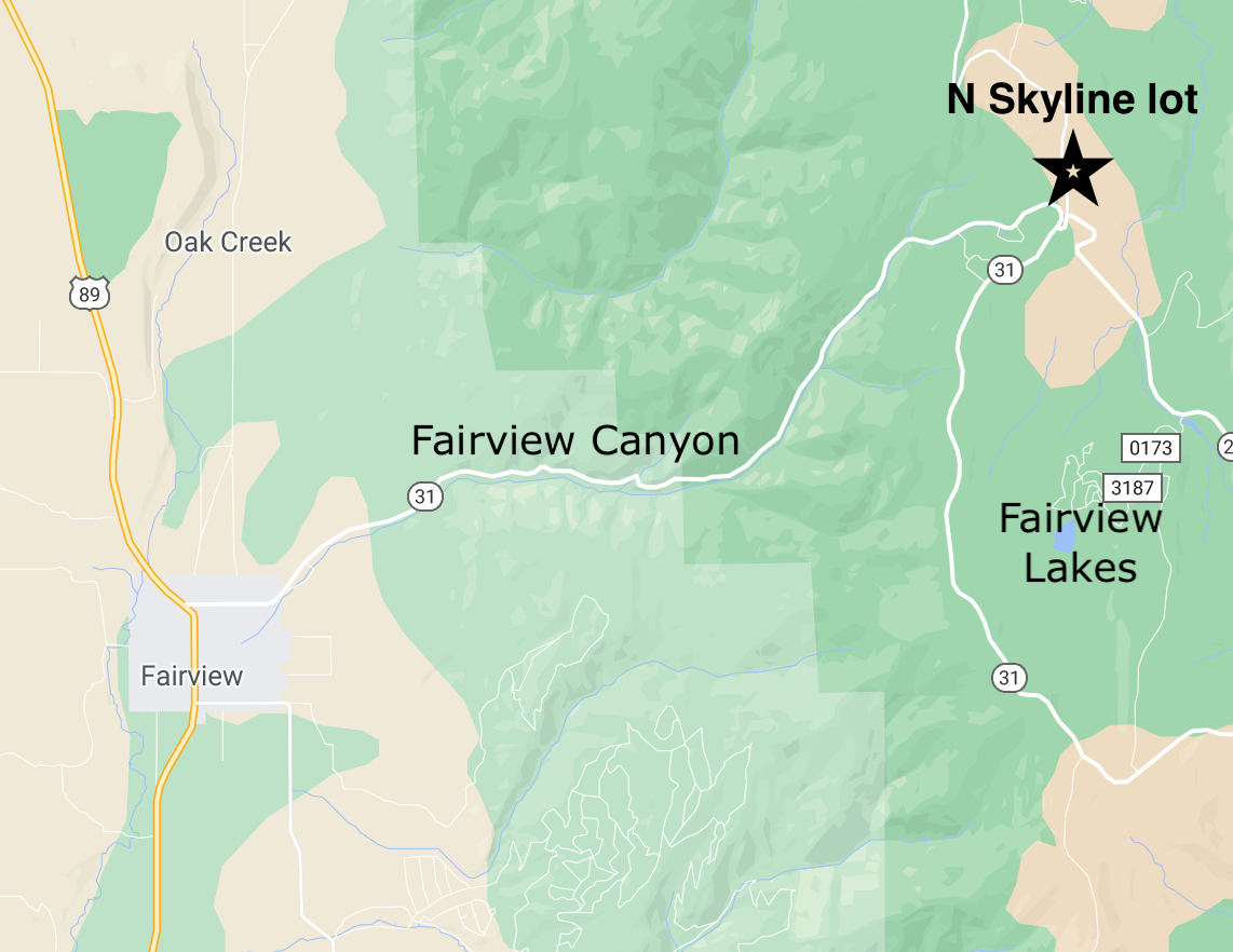
Where: North Skyline Drive parking lot at the top of Fairview Canyon.
How it works: Show up anytime between 9am and 1pm and we'll spend an hour to an hour and a half showing you how to perform an effective beacon search.
Weather and Snow
Current Conditions: Friday's storm under produced anticipated snow amounts. Many areas only picked up a few inches. The higher amounts were 4 to 5 inches containing .4 to .5 inches of water. The new snow was quite dense. The west wind was blowing at moderate speeds. It was enough that you didn't want to linger around on certain ridgetops too long. There was definitely enough wind to drift the new dense snow and load lee facing slopes.
Mountain Weather: On paper, today's storm looks like it is on track and should produce a good shot of snow. Models are all pumping out 1" of water or more which translates to roughly a foot of snow by Sunday. However, I can't help but be skeptical because of poor weather model performance recently. To me, the big picture looks like the storm wants to split and dive south putting us in not such an ideal location for large amounts of snow. We'll see. Temperatures start out in the mid 20s and will drop today as quite cold weather moves in. The wind should increase a bit this morning and switch to the southwest then veer northwest late today.
Ad
Avalanche Problem #1
Persistent Weak Layer
Type
Location
Likelihood
Size
Description
The base of our snowpack consists of a foot or more of loose sugary faceted snow grains. On top of that we have a few layers that are a bit stronger. This is an unstable set up and we are adding more layers on top. If we see a foot of snow and a little bit of wind, the dangerous situation will get more dangerous. Human triggered avalanches will be almost certain.