Snow
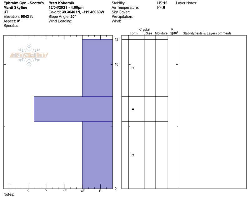
There is currently 6 to 12 inches of snow in the higher terrain of the Manti Skyline. This snow is from storms that occurred in October. This snow became weak and sugary in some higher northerly facing locations. Enough so that I have some concerns that this weak snow may produce avalanches once it is buried. Now, I'm not saying it's "doomsday" at this point, just something we should be aware of. It will be my main focus during upcoming fieldwork when I analyze the snowpack. It may take a few storms before we are able to determine how this weak snow will have an effect on the avalanche conditions. Below is a general snow profile of higher elevation northerly facing terrain.
Mountain Weather
A pretty decent looking winter storm will start tonight, Weds, Dec 8 and last through Thursday. Looks like the Manti Skyline is in good position as the storm trough moves through. Snow should start around midnight. Looks like we'll have decent wind speeds for orographic enhanced snowfall. The wind will have a southwest direction most of the event which should favor Fairview Canyon/Skyline Summit. It looks fairly warm during this period which may produce higher density snow. The flow switches northwest late Thursday with colder air moving in. Ephraim Canyon could light up pretty good then. Most models are generating .9 to 1.5” H2O. 10 to 15” of snow I’d say is reasonable to expect. One model is optimistic pushing 2" of water which translates to over 2 feet of new snow. Let's hope that is the solution that verifies!!