Forecast for the Skyline Area Mountains

Brett Kobernik
Issued by Brett Kobernik on
Monday morning, December 27, 2021
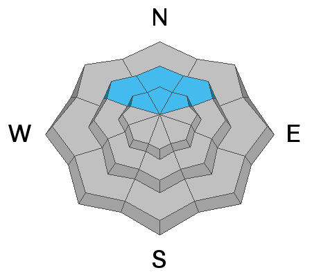
Strong wind forming large drifts on slopes with buried weak snow is keeping the avalanche danger HIGH. Travel in avalanche terrain is not recommended. Stick to low angle slopes until we see improvement in snow stability.
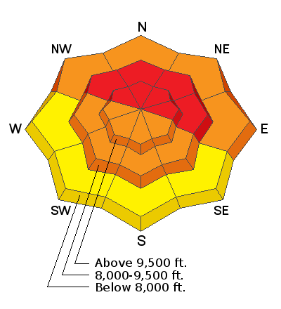
Low
Moderate
Considerable
High
Extreme
Learn how to read the forecast here
Avalanche Warning
THE AVALANCHE DANGER IS HIGH WITH DANGEROUS AVALANCHE CONDITIONS.
AN AVALANCHE WARNING HAS BEEN ISSUED FOR THE MOUNTAINS OF MUCH OF THE STATE OF UTAH, INCLUDING THE WASATCH RANGE...BEAR RIVER RANGE...UINTA MOUNTAINS...AND THE MANTI-SKYLINE.
HEAVY DENSE SNOWFALL AND STRONG WINDS HAVE CREATED DANGEROUS AVALANCHE CONDITIONS. BOTH HUMAN TRIGGERED AND NATURAL AVALANCHES ARE LIKELY. STAY OFF OF AND OUT FROM UNDER SLOPES STEEPER THAN 30 DEGREES.
Weather and Snow
Current Conditions
The wind raged on Monday with VERY strong speeds from the southwest. It slowed somewhat overnight but is still blowing pretty strong. Some snow fell over the last 24 hours but it is difficult to get an accurate measurement because of all the drifting at the weather stations. It looks like the Skyline picked up around 3 to 5 inches of new snow. Overnigh temperatures were in the mid teens.
Mountain Weather
It's going to be a nasty day in the mountains with clouds, strong southwest wind and occasional snow flurries later on. High temperatures are going to stay in the mid teens. A more organized system will move through tonight bringing more snow. I'm expecting 3 to 6 inches more snow tonight. Tuesday and Wednesday look cloudy with quite cold temperatures. More storms are shaping up for Thursday and Friday. The long term still looks active.
Ad
Avalanche Problem #1
Persistent Weak Layer
Type
Location
Likelihood
Size
Description
The biggest concern today is an avalanche that breaks deep into a persistent weak layer of sugary snow from October. Here is what we know:
  • A distinct layer of sugary faceted snow from October formed and got buried by snow in mid December.
  • Widespread natural avalanches released on Dec 24 during a snow storm with deep, heavy, dense snow.
  • The wind has been relentless over the last 24 hours forming large drifts.
Here's what we don't know:
  • Did the wind drifting cause natural avalanches on Monday?
  • How sensitive is the buried layer of faceted snow still?
We will get some answers when the dust settles. In the meantime, there is enough evidence pointing to dangerous avalanche conditions to warrant extreme caution.
Additional Information
  • Always follow safe backcountry travel protocols. Go one person at a time in avalanche terrain, while the rest of your party watches from a safe area.
  • Check your avalanche rescue equipment, change your batteries, and practice often with your backcountry partners.
  • Be very careful, keep your speed down, and stay in control. Encounters with shallowly buried rocks or down trees in the early season have led to many season-ending injuries.