Forecast for the Skyline Area Mountains

Brett Kobernik
Issued by Brett Kobernik on
Wednesday morning, December 26, 2018
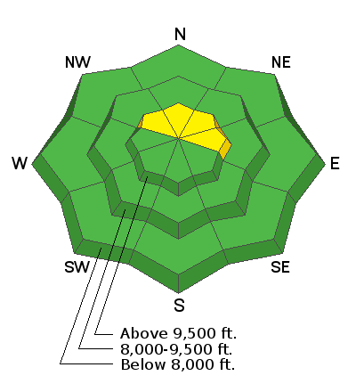
The avalanche danger is MODERATE on steep upper elevation slopes that face northwest, north, northeast and east. Any areas where fresh wind drifts of snow have formed may be sensitive today. Outside of the described terrain, the avalanche danger is generally LOW and you can travel around without too much fear of triggering an avalanche.
Low
Moderate
Considerable
High
Extreme
Learn how to read the forecast here
Weather and Snow
Another few inches of snow fell overnight and a few more may trickle in yet this morning before the storm wraps up mid day today. This brings us up to bout 4 inches in the last 24 hours. The flow has shifted to the northwest and the wind is light to moderate in speed. Mountain temperatures are in the upper teens. The next storm moves through on Thursday into Friday and might bring 2 to 4 more inches.
Ad
Additional Information
This forecast is from the U.S. Forest Service, which is solely responsible for its content. This forecast describes general avalanche conditions and local variations always occur.