Forecast for the Skyline Area Mountains

Issued by Brett Kobernik on
Thursday morning, December 27, 2018
Thursday morning, December 27, 2018
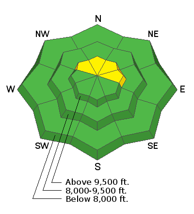
New snow coupled with an increase in wind speeds on Wednesday has created a MODERATE avalanche danger in the higher terrain. The most dangerous areas are on steep slopes above 9500 feet that face northwest, north and northeast. This terrain has some weak sugar snow near the ground and the fresh wind drifts are adding stress to this weak snow. East facing terrain is not as dangerous as the northerly slopes but watch for fresh wind drifts here as well. Outside of the terrain described, the avalanche danger is generally LOW.

Low
Moderate
Considerable
High
Extreme
Learn how to read the forecast here


