Forecast for the Skyline Area Mountains

Brett Kobernik
Issued by Brett Kobernik on
Tuesday morning, December 25, 2018
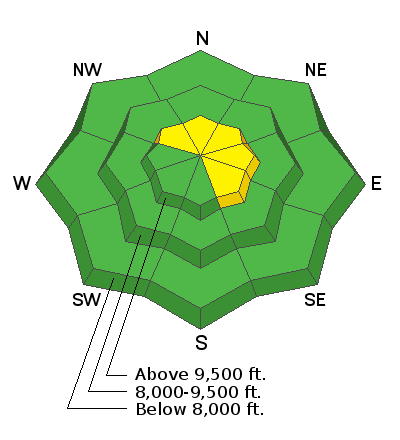
The avalanche danger will increase a bit today as wind and some new snow accompany a storm during the day today. A MODERATE avalanche danger will be present anywhere you find fresh drifts of wind blown snow especially along the higher ridgelines. Watch for cracking within the new snow which indicates things are sensitive. Outside of the wind affected snow, the danger is generally LOW.
Low
Moderate
Considerable
High
Extreme
Learn how to read the forecast here
Weather and Snow
We picked up a few more inches of snow overnight. The wind was blowing the new snow a bit in the canyon bottoms so I'm sure we'll find some fresh drifts along the high ridges.

Weather Outlook:
We should see some periods of snow today and into tonight. I think if we get another 3 to 5 inches of snow, we'd be doing well. Snow showers may linger into Wednesday. Temperatures are going to get cold into the weekend. Another round of snow looks like it will come on Thursday into Thursday night bringing another 2 to 4 inches or perhaps a bit more. We'll see weather clear out for the weekend. Another storm system is possible for early next week, we'll see how this unfolds.
Ad
Additional Information
My partner and I went out to analyze the 'now buried snow' from the mid December dry period. We are always concerned that the snow surface will become weak during long periods of dry weather. If the weak layer forms on the surface and then gets buried, it can produce a "persistent weak layer" which can cause avalanches for an extended period of time. Our observations and tests didn't find anything alarming. It appears we squeaked through this period without a dangerous weak layer forming on the surface. We'll continue to keep an eye on this layer through the week.

This forecast is from the U.S. Forest Service, which is solely responsible for its content. This forecast describes general avalanche conditions and local variations always occur.