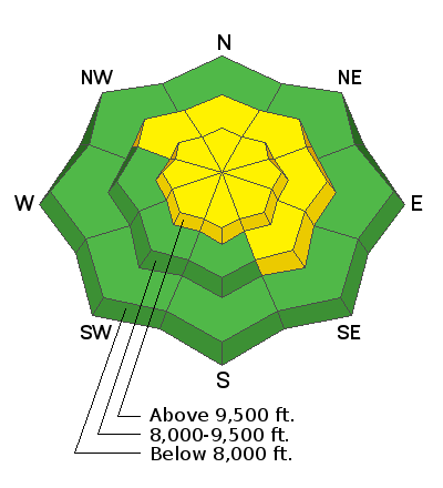
Current Conditions: Under the new powder lies a variety of old snow surfaces from bullet proof firm wind boards to bottomless sugar. This makes travel a bit tricky as in some places you're bouncing off the hard underlying snow and some places your punching right through to the ground. Overnight we picked up a couple of inches of fluff. Temperatures dipped into the single digits and low teens. West wind bumped up in speed a bit along the ridges but nothing too outrageous.
Mountain Weather:
The weather pattern is unsettled with cold air and periods of snow over the next few days. Accumulations won't be huge but we should get a few inches here and there. We might see a bit more snowfall this morning in a southwest flow. Highs today will be in the upper teens. Wind looks pretty light. The flow shifts southeast later in the day and we should see another shot of snow tonight which will most likely favor places like Ferron Canyon on the east side of the range.
The longer range forecast looks pretty active still with more water being advertised through early February.


