Current Conditions: The recent wind sure did wreak havoc on a lot of our snow in the higher terrain. Many people noted that large fresh drifts have formed. However, it appears that not all that many released naturally during the wind event. There have not been any significant observations of cracking within these recently formed drifts either. This would indicate that these drifts are already stabilizing. I would still use caution in very steep terrain where fresh drifts and wind slabs are present.
Mountain Weather: It looks like we'll see partly cloudy skies today with high temperatures around 30˚F. Southerly winds are again expected to increase and could get fairly strong along the ridges. The next quick hitting storm will move through early Friday and into mid day. It looks like a decent little punch although the duration is fairly short so I'm only expecting around 6 inches of new snow. The weather clears up for the weekend.
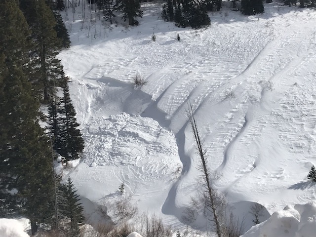
This is about the extent of the recent activity. This is a small drift that naturally released in the mid part of Fairview Canyon on a west northwest facing slope visible from the road. There were a few more small slabs that were reported to have released during the wind event. This activity is less than I expected which is good news.