Under mostly cloudy skies, the current mountain temperatures are in the mid-twenties °F. Upper elevation free air winds (11,000') are from the west-northwest and blowing 20-30 mph gusting 35. Ridgetop (9,000'-10,000') winds are also from the west-northwest blowing 10-15 mph.
A weak storm will cross into northern Utah this morning, and snow should fill around 10:00 am. This storm is forecasted to bring 1-3" of new snow and an increase in wind speeds on a northwest flow. Winds could reach 25-35 mph with gusts into the 50's at the upper elevations. Ridgetop speeds will also increase to 15-25 mph gusting into the 30's.
Monday into Tuesday's trough is still on track, and we should see 4-8" of new snow by Wednesday morning. After that, the flow begins to split once again, and we are back to the dribs and drabs of snow for the rest of the extended forecast. For the optimistic fans - there is a larger trough in the forecast models on the 16th.
Our
Week in Review for Dec 25-31
has been published. Catch up on the significant weather and avalanche events from this past week.
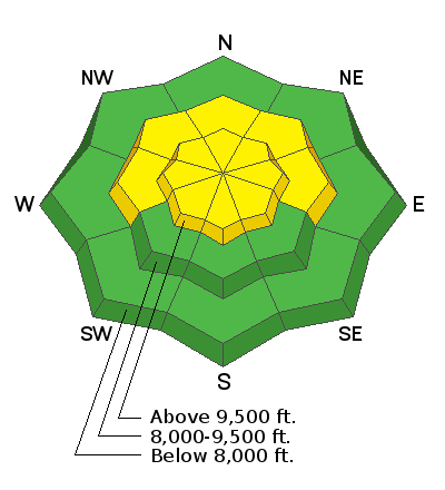
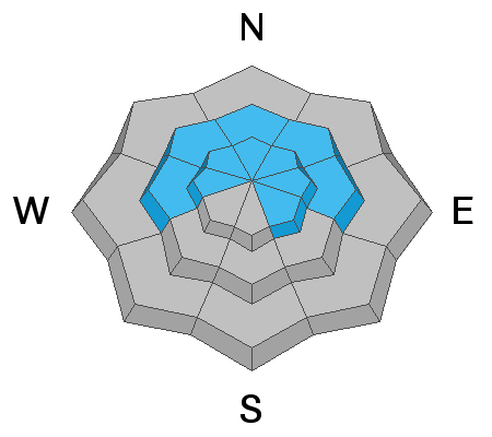
No new avalanche activity was reported in the Provo Mountains. Yesterday in the Wasatch Range, a snow safety team pulled out two avalanches with explosives that were large enough to bury a human on a steep upper elevation NE facing slope in Big Cottonwood Canyon. The same department also reported an intentional skier triggered slide 40' wide and 20" deep on the same aspect and elevation in Silver Fork.
One backcountry rider also reported triggering an avalanche in the
Catherines Pass Area. This avalanche was triggered even though there were lots of tracks already on the slope. The avalanche was on an NE facing slope at roughly 10,000' in elevation. The avalanche was 2.5' deep x 30' wide.


