Forecast for the Moab Area Mountains

Eric Trenbeath
Issued by Eric Trenbeath on
Thursday morning, March 12, 2020
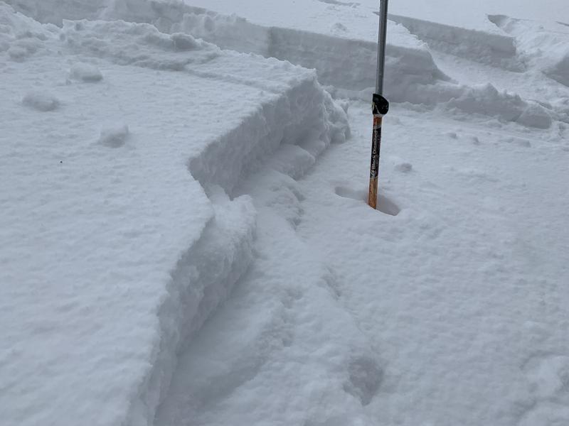
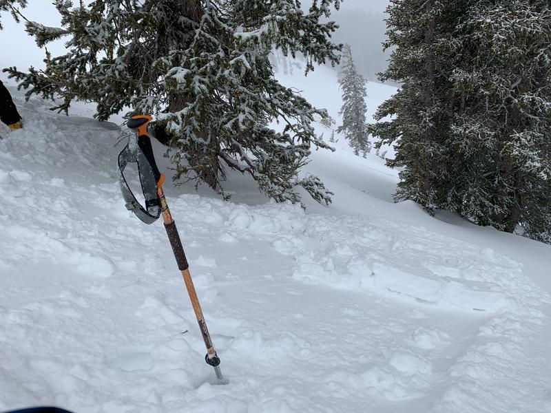
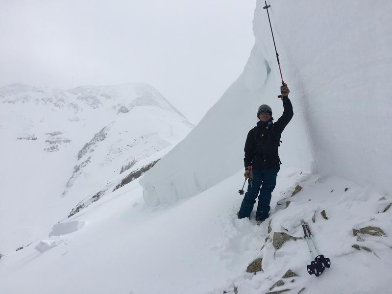
Recent snow at upper elevations and rapidly warming temperatures today will create a MODERATE avalanche danger. At upper elevations, shallow soft slab avalanches may be possible on steep slopes that have more than about 6" of new snow. As the day heats up the new snow will become more susceptible to sliding on sunny aspects. The old snow will also be affected and loose wet avalanches will be possible on sun-exposed slopes at all elevations. Pay attention to signs of instability such as pinwheels, roller balls, and loose wet sluffs, and stay off of steep slopes that are wet and punchy.
Low
Moderate
Considerable
High
Extreme
Learn how to read the forecast here
Special Announcements
Road Conditions: The road is a mix of dirt, mud and packed snow that gets sloppy later in the day.
Grooming Report: Trails were last groomed on Friday.
Weather and Snow
24 Hour Snow 2" Weekly Snow 3" Base Depth in Gold Basin 54" Wind W 5-10 mph Temp 29F
Wind, temperature, humidity on Pre Laurel Peak (11,700')
Storm totals at Gold Basin Study Plot (10,000').
Snotel site near Geyser Pass Trailhead (9600').
NWS weather forecast.
Weather: Yesterday's storm, though only producing 2" at the Gold Basin Study plot, delivered a surprise 6" of dense, heavy snow higher up in the basin. The rain/snow line crept up to around the Geyser Pass Trailhead (9600') while 10,000' temps hovered just above freezing most of the day. Southerly ridgetop winds averaged 10-15 mph with gusts to 30. Today look for mostly sunny skies, light WNW winds, and very warm temps in the low 40's. We should see increasing clouds later today as the much anticipated low off the Southern California coast moves inland. This moist system has the potential to give us a good shot of snow tomorrow but there are still a few discrepancies in the models. Keep your fingers crossed!
Snowpack: Our intrepid observers Dave Garcia and Reed Kennard braved the soggy weather yesterday and were duly rewarded with a "northwest powder day." Read their observation here. The new snow has improved conditions at upper elevations but the old snow surface was a widely variable mix of sun and wind crusts with occasional areas of soft snow. Underneath, the pack is equally as variable, with lots of loose, weak, sugary snow hanging around on shady aspects below treeline, and moist, punchy conditions at lower elevations or on sun-exposed slopes.
Ad
Avalanche Problem #1
New Snow
Type
Location
Likelihood
Size
Description
Soft slab avalanches involving the most recent snow may be possible on steep slopes on all aspects at upper elevations where there is more than about 6" of new snow. Look for signs of instability such as cracking in the snow surface. As the day heats up, the new snow will become even more susceptible to sliding. Even a small avalanche triggered in the wrong terrain can have devastating consequences.
These shallow soft slabs were easily triggered yesterday where the new snow bonded poorly to the old snow surface. Dave Garcia photos.
Avalanche Problem #2
Wet Snow
Type
Location
Likelihood
Size
Description
As temperatures soar today, the danger for wet slide activity will increase on sun-exposed slopes. Look for signs of instability such as pinwheels, roller balls, and loose wet sluffs, and stay off of steep slopes that are wet and punchy.
Additional Information
One year ago we had a historic avalanche cycle in the La Sals. A notoriously bad persistent weak layer had been plaguing the snowpack for most of the season when weekly water totals of 3" and strong SW winds broke the scales triggering this massive avalanche in Horse Creek on the NE facing ridge up to Pre Laurel Peak. The average depth was more than 6' and it measured 2500' wide. Within days, another 3" of water and 32" of snow would bring the house down! Stay tuned for more pics.
Observer Dave Garcia at the crown of a massive avalanche in Horse Creek observed on March 9, 2019. Mark Staples photo.
General Announcements
Check out the avalanche beacon training park at the Geyser Pass Trailhead and practice your rescue skills!
This forecast is from the U.S. Forest Service, which is solely responsible for its content. This forecast describes general avalanche conditions and local variations always occur.