Forecast for the Moab Area Mountains

Eric Trenbeath
Issued by Eric Trenbeath on
Wednesday morning, March 11, 2020
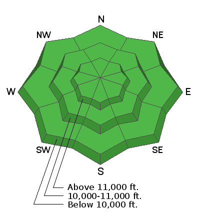
Most terrain has generally LOW danger. That said there are still areas where one could trigger an avalanche. Overnight refreezes have been marginal and the potential exists for loose wet avalanches that may even gouge deeper in the snowpack. Stay off of steep slopes that are wet or punchy. It may also be possible to trigger a dry avalanche in areas of steep, extreme, northerly facing terrain right around treeline and below, where the snowpack is thin and weak. Practice safe travel techniques with an eye toward subtle terrain features that may harbor lingering instabilities.
Low
Moderate
Considerable
High
Extreme
Learn how to read the forecast here
Special Announcements
Road Conditions: The road is a mix of dirt, mud and packed snow that gets sloppy later in the day.
Grooming Report: Trails into Gold Basin were groomed on Friday, and Geyser Pass through the Loppet Loop were rolled out.
Weather and Snow
24 Hour Snow 0" Weekly Snow 1" Base Depth in Gold Basin 54" Wind SW 15-20 G30 mph Temp 31F
Wind, temperature, humidity on Pre Laurel Peak (11,700')
Storm totals at Gold Basin Study Plot (10,000').
Snotel site near Geyser Pass Trailhead (9600').
NWS weather forecast.
Weather: Trace amounts of snow fell in the mountains yesterday. Today look for increasing clouds and snow showers this afternoon with 1"-2" possible. SW winds will average 10-15 mph and high temps will be in the upper 30's. On Friday, the much anticipated mid-level low will move inland off the Southern California coast. Taking a southern track, this storm could produce a decent shot of snow for us, or it could clip by to the south. Stay tuned.
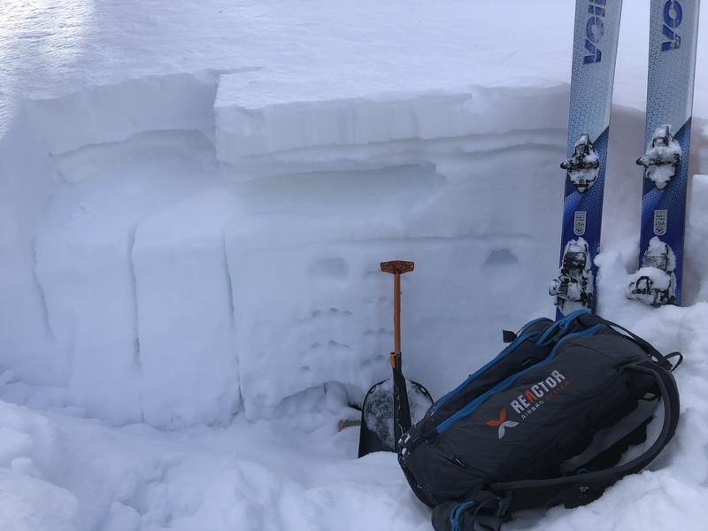
Snowpack: Spring conditions are in effect. Overnight freezes have been marginal and most surfaces at mid and lower elevations will be punchy and unsupportable. Firm and wind blasted surfaces exist in the alpine. Occasional areas of soft, powdery snow can still be found on sheltered aspects. Joey spent the weekend running around the mountains down here and sent in this observation. We really appreciate visitors taking the time to do this and outsider perspectives on our snowpack are very valuable. Thanks!
There is still plenty of loose, weak, sugary snow hanging around on shady aspects right around treeline and below. In some areas, this underlying snow is completely unsupportable. On sun exposed slopes the upper layers are becoming saturated, and in some shallow snowpack areas, the weak, faceted snow underneath is wet to the ground.
Loose, weak, faceted snow makes up much of the underlying snowpack on shady aspects. In isolated areas, a shallow soft slab can be found on top.
Ad
Avalanche Problem #1
Normal Caution
Type
Location
Likelihood
Size
Description
The danger is generally LOW but as our weak, wintery snowpack transitions into a spring-like snowpack there are still some isolated concerns out there:
Wet Snow: With marginal refreezes overnight, many surfaces are punchy and unsupportable. Stay off of steep slopes if you find yourself punching through into wet and sloppy snow.
Persistent Weak Layer: In areas where the snowpack is less than about 4' deep, the snowpack on northerly facing slopes is comprised almost entirely of loose, weak, sugary facets. This condition is generally found right around treeline and below. In some of these areas, a soft cohesive slab from last week's storm is sitting on top. You may be able to trigger this slab in areas of very steep, rocky, or sparsely treed, radical terrain. Shallow areas near rock outcroppings or along slope margins are likely trigger points. Even a small avalanche triggered in these areas could have devastating consequences.
Additional Information
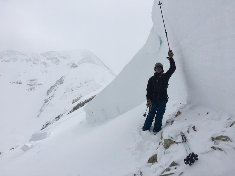
One year ago we had a historic avalanche cycle in the La Sals. A notoriously bad persistent weak layer had been plaguing the snowpack for most of the season when weekly water totals of 3" and strong SW winds broke the scales triggering this massive avalanche in Horse Creek on the NE facing ridge up to Pre Laurel Peak. The average depth was more than 6' and it measured 2500' wide. Within days, another 3" of water and 32" of snow would bring the house down! Stay tuned for more pics.
Observer Dave Garcia at the crown of a massive avalanche in Horse Creek observed on March 9, 2019. Mark Staples photo.
General Announcements
Check out the avalanche beacon training park at the Geyser Pass Trailhead and practice your rescue skills!
This forecast is from the U.S. Forest Service, which is solely responsible for its content. This forecast describes general avalanche conditions and local variations always occur.