Forecast for the Moab Area Mountains

Issued by Eric Trenbeath on
Thursday morning, December 29, 2022
Thursday morning, December 29, 2022
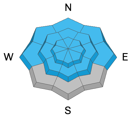
The avalanche danger is CONSIDERABLE and human triggered avalanches are likely on all aspects at all elevations. Dense, heavy, and wind drifted snow has overloaded buried persistent weak layers, and any avalanche triggered in the new snow has the potential to "step down" causing a deeper, much more dangerous avalanche. On northerly aspects, human triggered avalanches up to 4' deep are likely. Backcountry travelers need to have excellent route finding skills, and know how to avoid being on or under slopes steeper than 30 degrees.

Low
Moderate
Considerable
High
Extreme
Learn how to read the forecast here
 Special Announcements
Road Conditions: Grand County will be plowing the road today and it is going to take them some time. The gate will be closed while plowing is in progress. I do not recommend trying to beat them - the road is largely impassable.
Grooming: Trails are not groomed.
Didn’t get what you want for Christmas? Do your loved ones simply give you money for the holidays and say “Go buy something for yourself?” Support the UAC and get a great gift for yourself or your loved one at our Holiday Auction. The auction closes at 8:00 PM MT on January 2, 2023.
 Weather and Snow
24 Hour Snow 6" 72 Hour Snow 19" Season Total Snow 99" Base Depth at Gold Basin 50"
Winds on Pre Laurel Peak NW 5-10 Temp 13F
Weather
We'll see a break in the action today and maybe even some sunny skies before clouds build again this afternoon ahead of the next storm system. High temps today will be near 20F, and WSW winds will be mostly light. The next storm system is much weaker with only a few inches possible by Friday night. But have no fear, yet another potent looking system is queuing up to ring in the New Year!
General Conditions
Yesterday's storm delivered 19" inches of snow at 2.6" Snow Water Equivalent (SWE). This is very dense snow more akin to Sierra Cement than Utah Powder. If snow/water ratios had been normal for our area, it would have translated to almost 30" of light, fluffy powder! That's not to say that conditions aren't excellent. The dense snow makes for creamy riding and allows you to make turns on lower angle slopes which is good because it's dangerous out there. In our travels yesterday we experienced cracking in a dense storm slab, and widespread collapsing on W-SW aspects as the new load has re-awakened buried persistent weak layers down under. Blowing and drifting snow also added more stress to these weak layers on northerly aspects where human triggered avalanches up to 4' deep remain likely.
We received a couple observations from yesterday. If you're getting out in the backcountry please let us know what you are seeing by submitting an observation .
Snowpack and Weather Data
Gold Basin Storm Stake (10,000')
Gold Basin SNOTEL site (10,000')
Wind Station on Pre-Laurel Peak (11,400')
 Recent Avalanches
Poor visibility hindered any avalanche viewing yesterday. Here is a list of avalanches in the La Sals.
Avalanche Problem #1
Persistent Weak Layer
Type
Location

Likelihood
Size
Description
A persistent weak layer (PWL) of faceted snow that developed during the cold dry period in mid November exists on almost all aspects and elevation bands in the La Sal range. Dangerous avalanche conditions exist on any slope that harbors this buried PWL. In our travels yesterday, we experienced widespread collapsing on W-SW aspects where the recent snow load has reawakened this PWL. On northerly aspects, wind drifted snow has created additional stress, and human triggered avalanches up to 4' deep are likely. The snowpack is undergoing a severe test right now, and this process will continue into next week. Once this next load is applied, we'll have a better idea about the future of our snowpack. For now, all slopes steeper than 30 degrees should be avoided.
Avalanche Problem #2
New Snow
Type
Location

Likelihood
Size
Description
With nearly 20" of recent, dense snowfall, it remains possible to trigger a slab avalanche within the most recent snow on steep slopes on all aspects. Any avalanche triggered in the new snow has the potential to step down into a buried PWL causing a deeper and more dangerous avalanche. Travel advice remains the same. Avoid slopes steeper than 30 degrees.
Additional Information
General Announcements
This forecast is from the U.S.D.A. Forest Service, which is solely responsible for its content. This forecast describes general avalanche conditions and local variations always occur. This forecast will be updated by 7:30 tomorrow morning.


