Forecast for the Logan Area Mountains

Paige Pagnucco
Issued by Paige Pagnucco on
Sunday morning, March 30, 2025
The avalanche danger is LOW today. Low danger does not mean no danger; use normal caution and continue to practice safe travel protocols in avalanche terrain. Mountain travel is inherently risky - avalanches, though unlikely, are always possible.
Low
Moderate
Considerable
High
Extreme
Learn how to read the forecast here
Special Announcements
Our Spring Campaign is in full swing, and there are two great ways to support forecasting, awareness, and education across Utah:
  • Donate to our Spring Campaign
  • Bid on items in our Spring Auction
Every dollar helps keep the backcountry community on top. Thank you for your support!
Weather and Snow
All of our mountain weather stations are below freezing this morning - a welcome sign in terms of avalanche activity. The snowpack took a beating from the heat last week but should be more supportable and stable today. The mountains picked up about 4 inches of new snow last night containing .6' of swe. Riding conditions should be improved and more consistent in areas where the surface has been rough. I expect wet avalanche activity to be dormant today, though any slope with fresh snow getting hit by strong late March sunshine is suspect. Today, I'd look for smoothed-out, lower-angle slopes for the best turning conditions. Snowmobilers have "go anywhere" conditions, though I'm not sure 4 inches is enough to cover up the bumps completely.
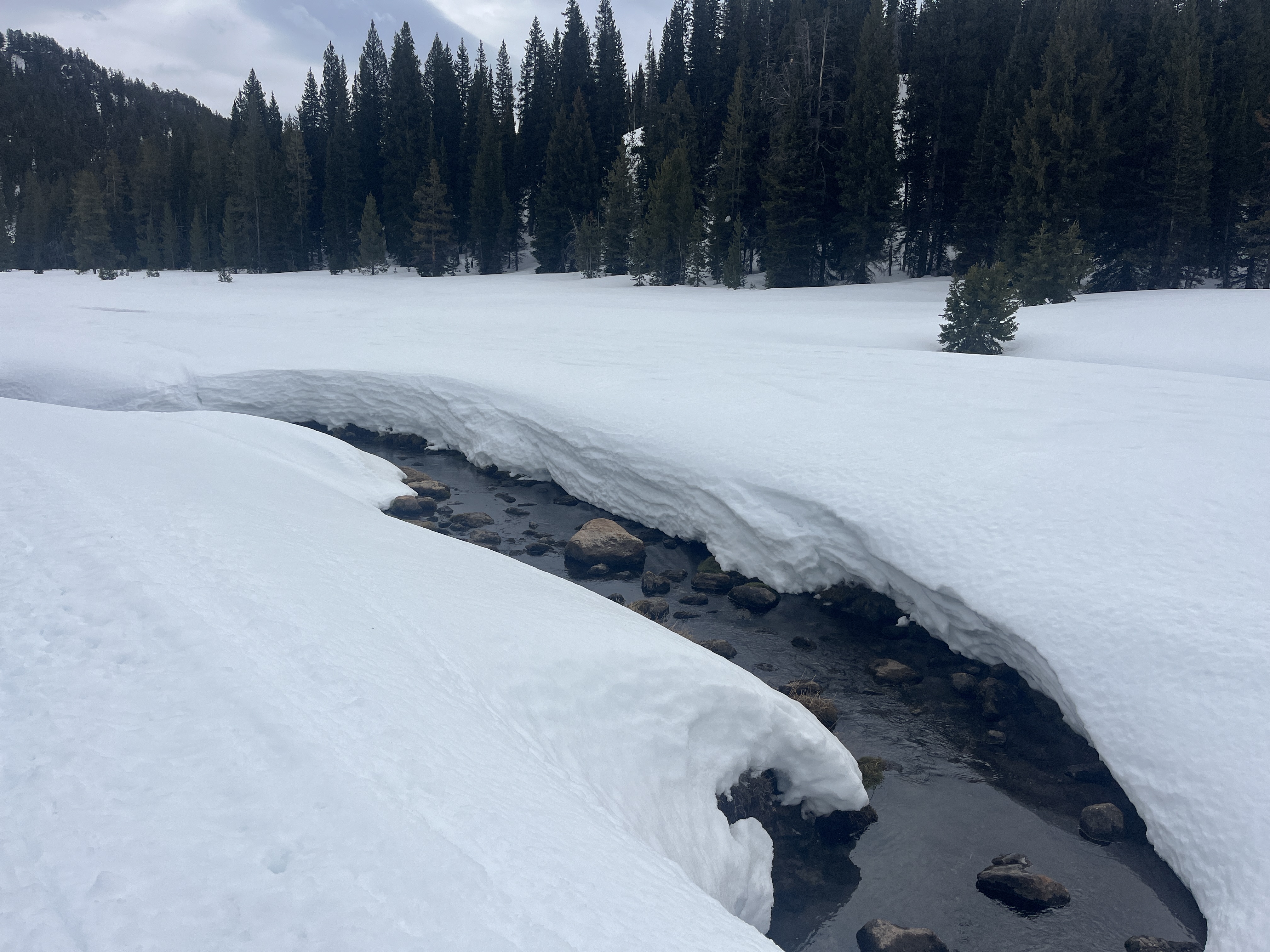
Beaver Creek and other mountain streams have opened up, creating another springtime backcountry hazard to consider. Snow bridges may be unsupportable.

The Tony Grove Snotel at 8400 feet reports 24° F, and there is 94 inches of total snow. Temperatures dropped to 22° F overnight at the Card Canyon weather station at 8800 feet and there is 71 inches of total snow. At 9700 feet at CSI's Logan Peak Wx station, light to moderate winds are currently blowing from the west, and it's 19° F. The winds on Paris Peak at 9500 feet are lightly blowing from the west-southwest, and it's 17° F.

It is currently snowing at Beaver Mountain, and there is about 4" on their snowstake. We may see some sun today, though clouds are expected to build in again midday. 8500' high temperatures will be in the mid-30s°F with light winds blowing from the west-southwest. Winter returns with a decent storm tomorrow - the mountains could pick up 6-12" by Tuesday evening.

For more information, visit the UAC weather page here: Weather - Utah Avalanche Center
For Logan-specific weather, go here: Logan Mountain Weather - Utah Avalanche Center
Recent Avalanches
No avalanches were reported yesterday though last week we observed many wet avalanches due to the heat. Read about all avalanches and observations HERE.
Ad
Avalanche Problem #1
Normal Caution
Type
Location
Likelihood
Size
Description
New snow avalanches - The new snow should bond well with the snow surface but you may trigger dry loose sluffs in very steep terrain.
Wind-drifted snow - There may be shallow slabs of wind-drifted snow along ridgelines. Cracking is a sure sign of instability.
Cornice - Cornices have been breaking off all week, and some have caused avalanches on the slope below. Avoid being on or underneath overhanging cornices, as they can break back much further than expected.
Wet avalanches—It's well into spring, and the sun is strong. Slopes with even a few inches of new snow may avalanche if the sun stays on them for too long or temperatures get warmer than expected. Rollerballs, wet sluffs, and pinwheels are signs of instability. If you are sinking in above your ankles, move to a cooler aspect or elevation or to lower-angle terrain.
Travel - Always practice safe travel protocols by exposing one person at a time in avalanche terrain. Everyone in your group must carry and know how to use avalanche rescue gear.
General Announcements
-National Forest Winter Recreation Travel Maps show where it's open to ride: UWCNF Logan, Ogden LRD Tony Grove, Franklin Basin CTNF Montpelier
-For all questions on forecasts, education, Know Before You Go, events, online purchases, or fundraising, call 801-365-5522.
-Remember the information you provide could save lives, especially if you see or trigger an avalanche. To report an avalanche or submit an observation from the backcountry, go HERE.
-Receive forecast region-specific text message alerts to receive messages about changing avalanche conditions, watches, and warnings. Sign up and update your preferences HERE.
-We are excited to announce the launch of our new mobile application available on both Android and IOS. Get all the information you need to plan your backcountry adventure and keep the information at the tip of your fingers while you are out. Install the Android version HERE and the IOS version HERE.

This forecast is from the U.S.D.A. Forest Service, which is solely responsible for its content. This forecast describes general avalanche conditions, and local variations always occur.