Forecast for the Logan Area Mountains

Paige Pagnucco
Issued by Paige Pagnucco on
Saturday morning, March 29, 2025
The avalanche danger is MODERATE today. Wet avalanches and large cornice falls are possible on steep slopes with saturated snow.
Evaluate snow and terrain carefully.
Avoid and stay out from under overhanging cornices as they could break further back than expected and could cause avalanches on slopes below.
Low
Moderate
Considerable
High
Extreme
Learn how to read the forecast here
Special Announcements
Our Spring Campaign is in full swing, and there are two great ways to support forecasting, awareness, and education across Utah:
  • Donate to our Spring Campaign
  • Bid on items in our Spring Auction
Every dollar helps keep the backcountry community on top. Thank you for your support!
The final Hoyt Peak (Uintas) accident report is HERE. Our condolences go out to everyone affected by the tragic accident.
Weather and Snow
Conditions are slowly changing and will become a bit more supportable after tonight. Low-elevation snow is almost non-existent, and what is left is unsupportable and cohesionless. It gets a bit better as you go up, but I'd give riding conditions about 1 star. The warmth has beat up the surface, and you'll find anything from firm and rough to sloppy and punchy snow across all aspects and elevations. Trailheads have melted out considerably with low elevations down to dirt. Once again, our biggest concern today will be wet avalanches and cornice falls. Temperatures only dropped below freezing since midnight (except for Paris Peak, which has been generally a bit cooler), which is not long enough to greatly improve stability. A weak storm rolls in this afternoon, and we may pick up 2-5 inches of snow at high elevations by tonight. The rain/snow line should hover around 6500'.
*** Spring Travel Advice: The danger of wet avalanches will rise with the temperatures, so get an early start and finish the day early. If you start sinking into saturated snow, it's time to pull the plug, reevaluate your route, or change your location.
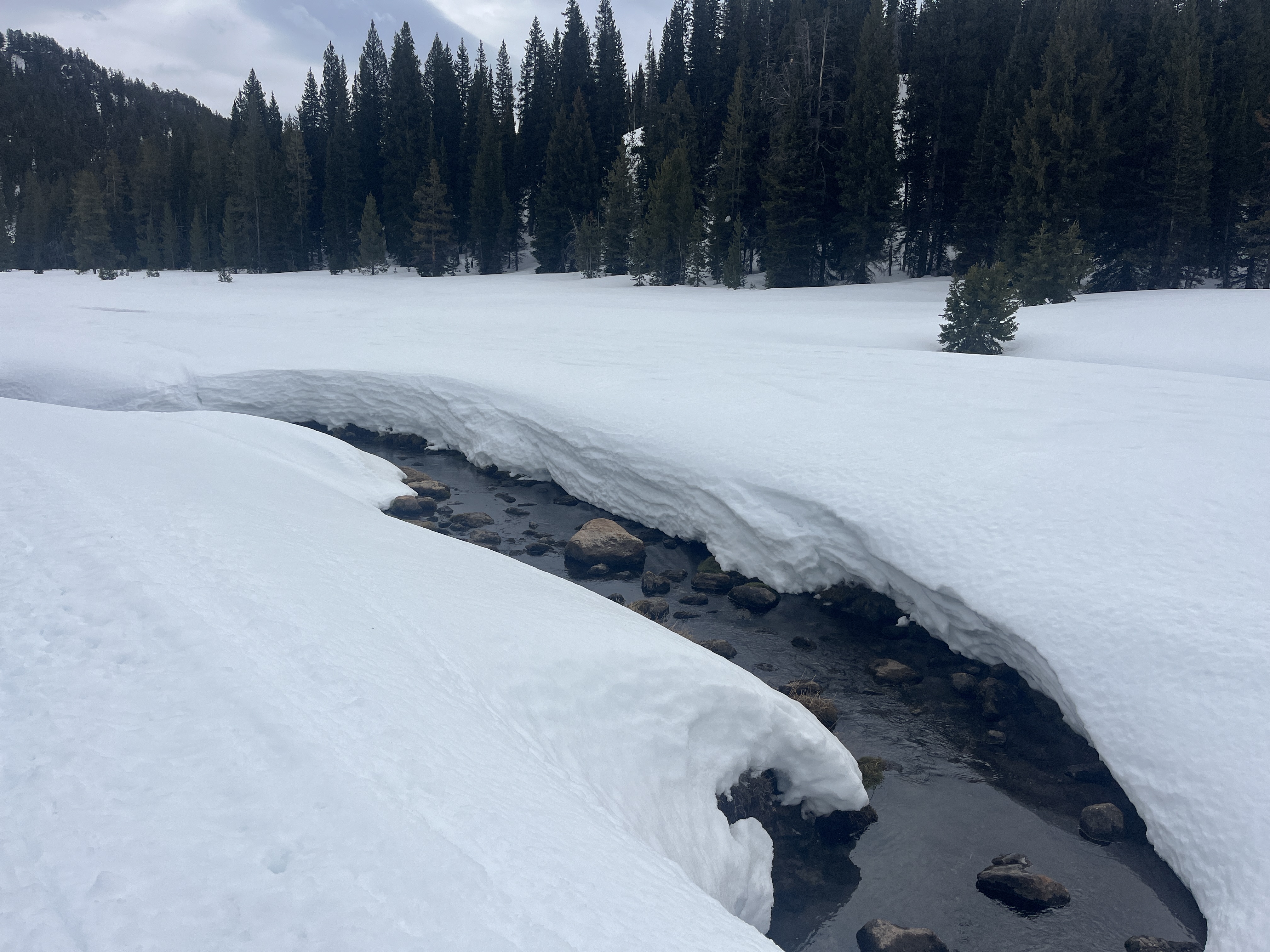
Beaver Creek and other mountain streams are melting and opening up, creating another springtime backcountry hazard to consider. Snow bridges may be unsupportable.

The Tony Grove Snotel at 8400 feet reports 29° F, and there is 90 inches of total snow. Temperatures dropped to 27° F overnight at the Card Canyon weather station at 8800 feet and there is 67 inches of total snow. At 9700 feet at CSI's Logan Peak Wx station, light winds are currently blowing from the east, and it's 24° F. The winds on Paris Peak at 9500 feet are lightly blowing from the west-southwest, and it's 22° F.

Today will be mostly cloudy in the mountains, with a chance of snow showers, mainly in the afternoon. Forecast snow totals range from 2-6", though the storm is losing strength. Light to moderate winds will blow from the northeast and switch to the northwest mid-morning with an 8500' high temperature near 41° F. Sunday brings a reprieve with partly sunny skies and cooler temperatures. Still, the pattern stays active for the work week, with a significant storm on tap for Monday night/Tuesday. *We've been seeing Sandhill cranes in the valley and the mountains - a sure sign of spring.

For more information, visit the UAC weather page here: Weather - Utah Avalanche Center
For Logan-specific weather, go here: Logan Mountain Weather - Utah Avalanche Center
Recent Avalanches
Yesterday, we observed a trio of recent wet slab avalanches in Rattlesnake Canyon in the Wellsvilles. They appear to have been cornice-triggered.

Read about all avalanches and observations HERE.
Ad
Avalanche Problem #1
Wet Snow
Type
Location
Likelihood
Size
Description
Many days and nights of very warm temperatures have caused the snow to remain saturated and unstable on some steep slopes. Given last night's poor refreeze and today's above-freezing temperatures, wet loose and wet slab avalanches are still possible.
  • Watch for rollerballs, pinwheels, and sluffs, as signs of instability.
  • If you sink up to your ankles in the mushy snow, it is time to move to a cooler aspect or elevation or to lower-angle terrain.
  • Avoid travel on steep slopes above trees or other terrain traps.
Avalanche Problem #2
Cornice
Type
Location
Likelihood
Size
Description
  • People should stay off of, out from under, and well away from the edges of large overhanging cornices, which are deceptive and often break much further back than expected.
  • Stay out from under the large cornices, as the heat will cause them to buckle and some to calve off large, school bus-sized chunks. With daytime warming, natural and human-triggered cornice falls are possible, and these could trigger avalanches on slopes beneath.
General Announcements
-National Forest Winter Recreation Travel Maps show where it's open to ride: UWCNF Logan, Ogden LRD Tony Grove, Franklin Basin CTNF Montpelier
-For all questions on forecasts, education, Know Before You Go, events, online purchases, or fundraising, call 801-365-5522.
-Remember the information you provide could save lives, especially if you see or trigger an avalanche. To report an avalanche or submit an observation from the backcountry, go HERE.
-Receive forecast region-specific text message alerts to receive messages about changing avalanche conditions, watches, and warnings. Sign up and update your preferences HERE.
-We are excited to announce the launch of our new mobile application available on both Android and IOS. Get all the information you need to plan your backcountry adventure and keep the information at the tip of your fingers while you are out. Install the Android version HERE and the IOS version HERE.

This forecast is from the U.S.D.A. Forest Service, which is solely responsible for its content. This forecast describes general avalanche conditions, and local variations always occur.