Forecast for the Abajos Area Mountains

Issued by Eric Trenbeath on
Friday morning, March 26, 2021
Friday morning, March 26, 2021
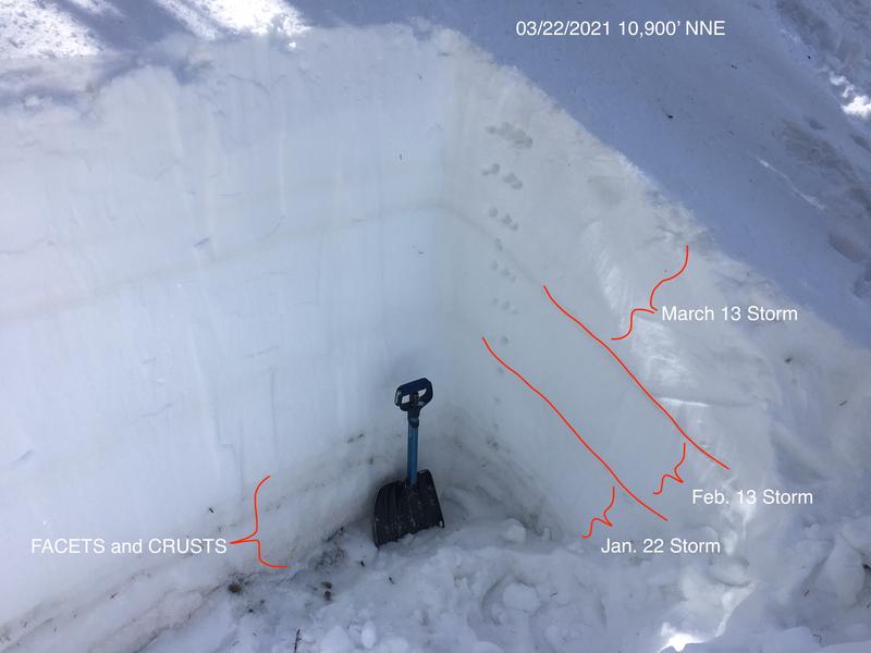
Recent and wind drifted snow has caused a rise in avalanche danger. The avalanche danger is CONSIDERABLE on steep, wind drifted slopes near and above treeline that face NW-N-E and human-triggered avalanches are likely in these areas. All other terrain has a MODERATE avalanche danger and human-triggered, soft slab avalanches involving the new snow are possible on slopes steeper than about 35 degrees. And finally, the recent snowload may increase the likelihood for triggering a deep and dangerous avalanche on a buried persistent weak layer. The danger for this type of avalanche is MODERATE on steep slopes facing NW-N-E. Thinner snowpack areas and slopes made up of steep, rocky terrain are the most likely trigger points.

Low
Moderate
Considerable
High
Extreme
Learn how to read the forecast here