Do you have the essential avalanche rescue gear (transceiver, probe, and shovel) and do you know how to use them?
Watch this video to see how the three pieces of equipment work together.
Another 6"-10" has fallen across the range with the south side favored. This brings snow totals since Friday up to 20" with more than 2' up high. SE winds ramped up overnight blowing in the 20-30 mph range with gusts into the 40's for a few hours. They started backing off around 2:00 a.m. Today will be mostly cloudy with moderate, ridgetop SW winds, and high temps in the mid-teens. Skies should clear overnight. By Wednesday, a strong atmospheric river event will slam into the Sierra Mountains. SW flow aloft ahead of a trough stalled off the Pacific Coast will feed moisture in the form of clouds into southern Utah while allowing for chances of snow through the remainder of the week to points north. By Friday, the trough will move across the Great Basin although with energy much diminished. We'll see a chance for snow Fri-Sat.
Snowpack Discussion
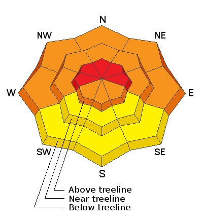
A significant load of snow combined with wind has created dangerous avalanche conditions in the Abajo Mountains. The underlying snowpack is very weak and is comprised of loose, sugary faceted snow. Dense drifts and slabs now overly this poor snowpack structure and conditions are very unstable. Mathew Cozart was up yesterday and he reported deep snow with widespread signs of instability such as cracking and collapsing on northerly aspects.
Read his report here.
On Saturday, after the first wave of snow fell, I also observed widespread signs of instability and conditions have only gotten worse. The video below illustrates the red flag signs of instability I observed.


