Forecast for the Uintas Area Mountains

Craig Gordon
Issued by Craig Gordon on
Wednesday morning, February 26, 2025
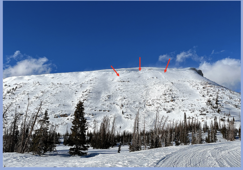
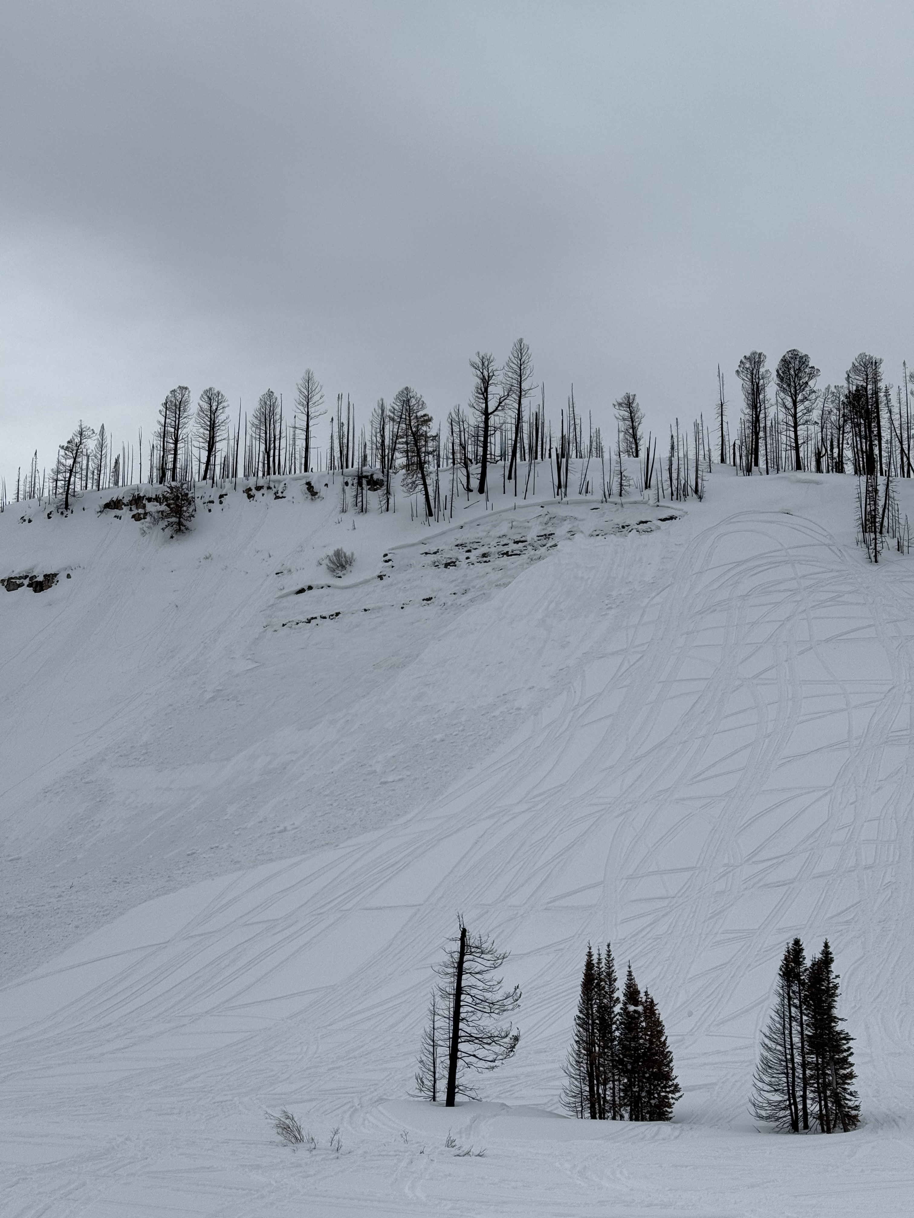
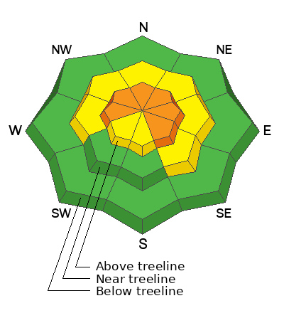
At and above treeline, expect CONSIDERABLE avalanche danger on steep slopes facing the north half of the compass where human triggered avalanches, breaking 3'-6' deep and failing on faceted snow near the ground are LIKELY. A bit more pockety, but still packing a punch, mid elevation terrain offers the same avalanche dragon... MODERATE avalanche danger exists and human triggered avalanches are POSSIBLE on steep, shady slopes with a shallow snowpack. In either case, while not as touchy as the past few days, any slide triggered will break deeper and wider than you might've bargained for.
In addition, MODERATE avalanche danger is found on steep, leeward slopes at upper-elevations where human triggered wind drifts are POSSIBLE.
Recent avy activity confirms the hazard is real so I'm sticking with the strategy of avoiding all steep terrain that harbors a persistent weak layer. But I'm not hiding under my bed, because great riding and straight-forward avy danger is found on low angle, wind sheltered, shady slopes with no overhead hazard.
Low
Moderate
Considerable
High
Extreme
Learn how to read the forecast here
Weather and Snow
Nowcast- In the wake of yesterday's dry, cold front, skies are clear and northwest winds blow in the mid 20's near the high peaks. Current temperatures register in the teens and single digits, or about 20 degrees colder than yesterday at this time. Recent temperature whiplash has had its way on the snow surface and it's sorta hit or miss. But don't let your hearts be troubled, swaths of soft snow are still found on mid and upper elevation, wind sheltered shady slopes... getting there is a bit rugged.
Forecast- Look for mostly sunny skies with highs climbing into the low 30's. Another blast of cool air slides through the region later today as winds shift to the north and decrease throughout the day. Overnight lows dip into the mid teens.
Futurecast- Copy and paste weather through the weekend. We can count on severe clear skies and warming temperatures as high pressure homesteads over northern Utah. But wait... there's more! A glimmer of hope for a stormy pattern emerges from the Ouija board to kick off the first week of March. We'll keep ya posted as deets materialize.
Bald Mountain looking pretty worked from sun, wind, and a school bus sized natural cornice fall which led to a large slide on the south face. Thanks Spencer for the intel and the Trial Lake snow profile!
Recent Avalanches
Andy explaining how the avalanche sausage was made on a recently triggered slide near Duchesne Ridge.
No shortage of recent avalanches this weekend. From the North Slope to the south half of the range, multiple, human triggered slides were reported, ending with a close call near the Buck Knoll. Check out the great video and detailed report, here -- thanks for sharing!
In addition, check out intel from across the range and beyond, here.
Ad
Avalanche Problem #1
Persistent Weak Layer
Type
Location
Likelihood
Size
Description
We stomped around treeline yesterday and found weak layers getting a little more stubborn, yet still reactive to our stability tests.
Mid and upper elevation terrain facing west through north through southeast are prime time slopes for harboring a complicated snowpack with multiple persistent weak layers, and the PWL really showed its personality this weekend. In fact, riders triggered numerous and notable slides, failing on a host of problematic weak layers, now buried 2-4' beneath the snow surface.
Here's where it gets tricky... we're not seeing the usual red flags like cracking and collapsing, but recent avalanches are natures freebie and the biggest red flag. So how do we manageable an unruly avalanche dragon? Simply steer clear of it and instead opt for non-avalanche terrain with no overhead hazard. Done and done!
This avalanche from Soapstone Mountain broke on a shallow, rocky, east facing slope at 9,800'. Tracks on a slope don't mean it's good to go. Whether it's on the first pull or the hundredth, all we need to do is find the sweet spot like near a bush or shallowly buried rock, collapse the pack (whoomph) and now we're off to the races with the roof crashing down on us.
Avalanche Problem #2
Wind Drifted Snow
Type
Location
Likelihood
Size
Description
Blowing from the south, west, north, and northwest for the past 72 hours, winds have been all over the map in upper elevation terrain. The good and bad news is... most of our surface snow took on heat over the weekend and there's not an abundance of snow available to blow around. But... it never ceases to amaze me how winds can channel through the mountains and still whip up a few hard drifts that'll react to our additional weight. Today's drifts might be stubborn and sluggish, but you'll still need to be on your toes and continue looking for and avoiding fat, rounded pillows of snow and listen for slopes that sound hollow like a drum.
General Announcements
We are always looking for snow and avalanche observations or just general riding conditions. In the meantime reach out to us with questions, concerns, or if you see anything in your travels! Contact us directly through the info below:
  • Craig Gordon | Craig@utahavalanchecenter.org, 801-231-2170, or
  • Andrew Nassetta | Andy@utahavalanchecenter.org, 860-460-8142.
This forecast is from the U.S.D.A. Forest Service, which is solely responsible for its content. This forecast describes general avalanche conditions and local variations always occur. This forecast was issued on Wednesday, February 26th at 04:00 AM and expires 24 hours after it was issued.