Forecast for the Skyline Area Mountains

Dave Kelly
Issued by Dave Kelly on
Friday morning, January 24, 2025
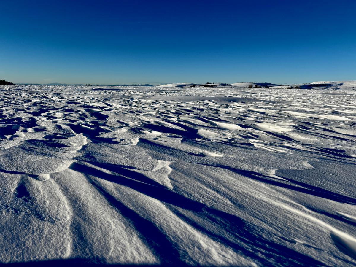
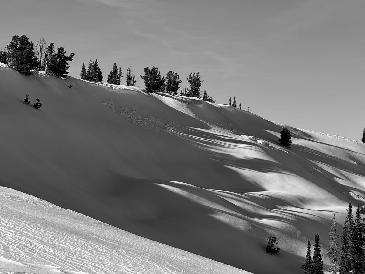
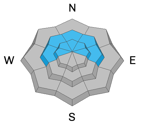
Today, the avalanche danger is MODERATE in mid and upper elevation terrain facing west-north-east and on upper elevation southeast facing aspects where it may be possible to trigger a wind-drifted snow avalanche on the downwind side of steep terrain.

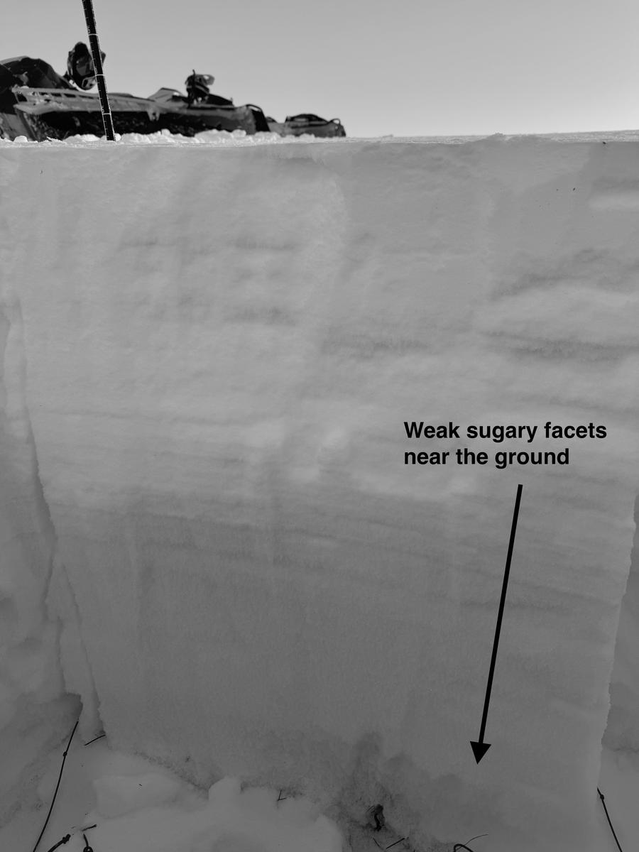
Some of these drifts have formed in areas that hold old weak sugary snow from November and December. This is the most dangerous situation as these could avalanche 2'-4' deep.
Low
Moderate
Considerable
High
Extreme
Learn how to read the forecast here
Special Announcements
URGENT!! Battery replacement required for anyone who received batteries from one of our participating "Batteries for Beacons" shops. We've found that the Duracell Procell AAA batteries are too short in length and may not make contact in avalanche beacons causing them to malfunction. DETAILS HERE
Weather and Snow
Under clear skies temperatures are much warmer than the last few days in the high teens to low 20's °F. Winds are blowing from the west-southwest in the moderate range. The highest weather stations are starting to blow from the southwest 29 gusting to 35 MPH.
Today, we'll have clear skies to start with building clouds. Temperatures will be 28-34 °F with winds blowing from the southwest 10 gusting to 15 MPH at the trailheads and 20 gusting to 30 MPH at the higher ridgelines. Look for increasing wind speeds later this afternoon with the chance of gusts to 45 MPH.

Over the last few days, the winds have destroyed much of the snow surface, we found mostly wind affected surface conditions above Ephraim Canyon (photo below), but did find some soft turns in protected north facing meadows.
Recent Avalanches
Yesterday, we saw of signs of previously reported wind-drifted snow avalanches on the plateau above Ephraim Canyon from a few days ago, but we didn't see any new slides. Check out all observations HERE.
Photo of a wind-drifted snow avalanche from a few days ago on east facing Haystack Mountain above Ephraim Canyon.
Ad
Avalanche Problem #1
Wind Drifted Snow
Type
Location
Likelihood
Size
Description
With an uptick in wind speeds through the day today be on the lookout for areas of wind drifted snow. These are the places to avoid, particularly on steeper slopes or those with fresh cornices above them. These drifts and slabs may be sensitive to people. The most likely places to find them are below ridgelines on northeast, east and southeast facing steep slopes. Simply avoid traveling on or underneath any steep slope that looks like the wind has been depositing snow onto it.
Avalanche Problem #2
Persistent Weak Layer
Type
Location
Likelihood
Size
Description
Loose sugary faceted snow at the base of the snowpack remains a concern especially in areas where the overall depth is less than about 3'. These areas have the weakest snow. The weak snow is most pronounced above 8000' in elevation on west, north, and east facing slopes. Recent wind has formed drifts and slabs on top of this weak sugary snow in many places. If you trigger one of it could break 2' to 4' deep and up to 200' wide.
Simply avoid any steep slope that looks like the wind has been depositing snow onto it.
Photo of weak sugary facets near the ground on a north facing slope in Little Pete's ( 9,700')
General Announcements
This forecast is from the U.S.D.A. Forest Service, which is solely responsible for its content. This forecast describes general avalanche conditions and local variations always occur.