Forecast for the Skyline Area Mountains

Dave Kelly
Issued by Dave Kelly on
Saturday morning, January 25, 2025
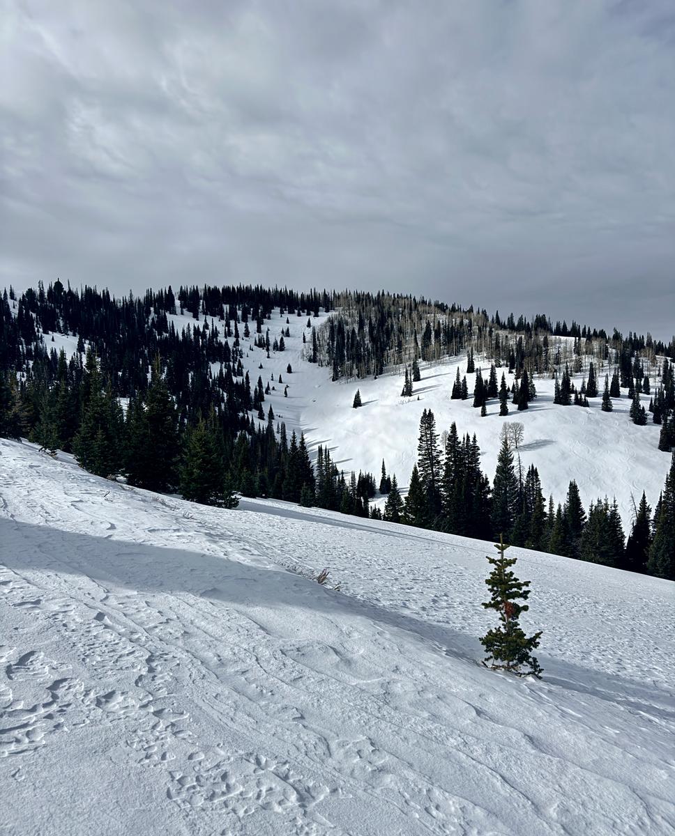
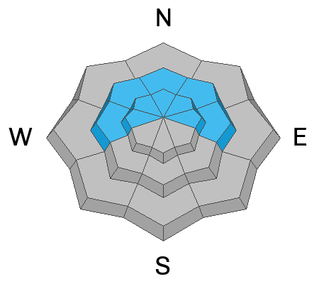
Today, the avalanche danger is MODERATE in mid and upper elevation terrain facing west-north-east where it may be possible to trigger an avalanche failing on weak sugary facets near the ground. The avalanche danger is LOW at all other elevations and aspects.
Evaluate snow and terrain carefully and identify thin shallow areas where it may be possible for humans to trigger an avalanche. If you step off your sled or out of your skis and sink straight to the ground, that is a sign that the snow you are traveling on is weak and faceted and it's time to find a lower angle (less than 30 °) slope to travel on.
Low
Moderate
Considerable
High
Extreme
Learn how to read the forecast here
Special Announcements
URGENT!! Battery replacement required for anyone who received batteries from one of our participating "Batteries for Beacons" shops. We've found that the Duracell Procell AAA batteries are too short in length and may not make contact in avalanche beacons causing them to malfunction. DETAILS HERE
Weather and Snow
Currently under cloudy skies, trailhead temperatures are in the mid-teens °F and the 10,000' weather stations are in the low teens °F. Winds at the lowest weather stations are blowing lightly and the highest weather stations are blowing from the southwest 8 gusting to 10 MPH.
Today, we should see cloudy skies with temperatures between 20-24°F. Winds will be light from the south at the lower elevations and from the southwest at the higher elevations 15 gusting to 25 MPH. We may see 1"-2" of snow and up to .10"-.20" of water.

While getting harder to find, there are still soft turns to be had in protected north facing meadows where the snow surface has faceted. Anywhere that receives the high end of snowfall today you can expect to see dry loose avalanches and shallow wind drifts on steep terrain.
Photo of snow surface near Electric Lake.
Recent Avalanches
Yesterday, there were no reports of avalanches. Check out all observations HERE.
We had a field day near Electric Lake and you can read our full observation HERE.
Ad
Avalanche Problem #1
Persistent Weak Layer
Type
Location
Likelihood
Size
Description
While the likelihood of triggering a persistent weak layer avalanche has gone down, the consequences remain the same. It may not take much additional wind or new snow to tip the scales and it will be possible for a human to trigger an avalanche failing 2'-4' deep. This will be more likely in thin, rocky, locations on steep terrain (greater than 30°) facing west-north-east at mid and upper elevations. A couple of days ago there were reports of whumpfing and collapsing on lower angle slopes near Electric Lake. This is a surefire sign that the weak faceted snow could still avalanche in steeper terrain.
General Announcements
This forecast is from the U.S.D.A. Forest Service, which is solely responsible for its content. This forecast describes general avalanche conditions and local variations always occur.