Join us at our 2nd Annual Blizzard Ball

Forecast for the Uintas Area Mountains

Craig Gordon
Issued by Craig Gordon on
Sunday morning, January 19, 2025
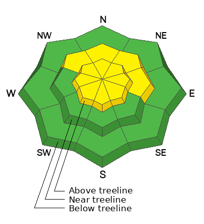
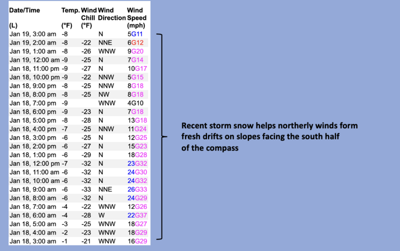
Today, expect MODERATE avalanche danger at and above treeline. Becoming pockety and harder to initiate, human triggered avalanches, breaking deeper and wider than you might anticipate are still POSSIBLE, especially in the wind zone on slopes facing northwest through north through southeast. In the more straight-forward and predictably manageable category... yesterday's storm snow coupled with a shot of robust, northerly wind delivers a round of fresh drifts on steep leeward slopes and human triggered wind slabs are also POSSIBLE, especially in terrain with a southerly component to its orientation.
LOW avalanche danger is found around the dial in wind sheltered terrain particularly at lower elevations, like near our trailheads.
Low
Moderate
Considerable
High
Extreme
Learn how to read the forecast here
Special Announcements
Save the date and take a date!
Please join Craig Gordon, that's me, Tuesday January 21st from 6:00-7:30 PM at Alpha Coffee in Cottonwood Heights for a State of the Snowpack presentation.
In addition, please join the UAC at Deer Valley on January 30th for the 2nd Annual Blizzard Ball Gala. The night will be full of fun including delicious cuisine, live music, an auction, and presentation by Bruce Tremper. More info found HERE.
Weather and Snow
Nowcast- Under-forecast and over-deliver... a business model that worked out rather well for the North Slope yesterday which stacked up 8" of snow and .36" H2O, which is barely a mention of water weight for all of you water weight trackers in the audience this morning :) Half that amount fell from Trial Lake through Currant Creek and Daniels got kinda skunked on this one and doesn't even get honorable mention. However, everyone gets invited to extremely cold temperatures this morning, starting the day off right around -8 degrees. Couple in northerly winds blowing in the teens and we've got dangerous windchill to -27 degrees. Yesterday's ultra-low density storm snow does little to cushion some of the old, rugged snow surfaces, but if you can stand the toe-numbing temperatures your best best is to seek out low angle, wind sheltered, mid elevation slopes.
Forecast- Looks like a band of high clouds drifts through the region early this morning and may bring a scattered snow shower or two. Very cold Arctic air delivers daytime highs that barely crack into single digit territory. West and northwest winds humming along in the 20's are not only obnoxious, they create dangerous windchill into the negative 20's... so keep an eye on each other today.
Futurecast- Partly sunny skies are on tap for Monday with the coldest temperatures of the year. Clear, cold, and calm through midweek.
Recent Avalanches
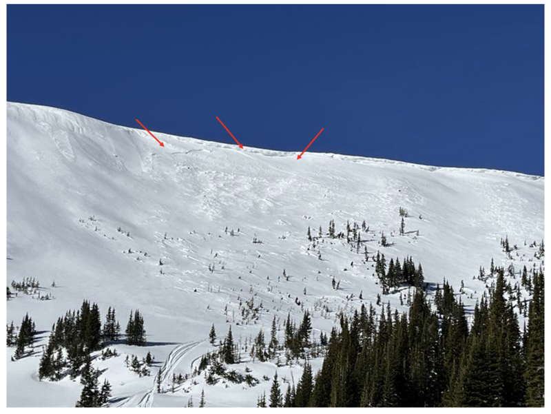
Most likely cornice triggered, our main man with the Uinta plan, Ted Scroggin, spotted this piece of snow Thursday peeling off a steep wind drifted slope on Double Hill in the Whitney Basin.
You can find trip reports and recent slides from across the range and beyond, here.
Ad
Avalanche Problem #1
Persistent Weak Layer
Type
Location
Likelihood
Size
Description
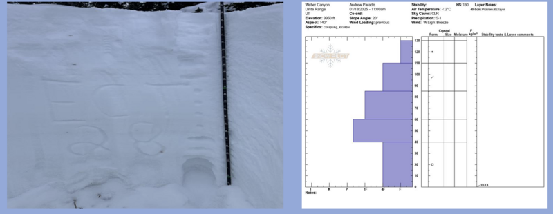
Profiles from opposite ends of the range. On the left, avy educator extraordinaire and rippin' rider, Micheal Davis reports his pit from Co-op... "Quick (2) pit/ect test on a north/northwest facing aspect produced a irregular (non planer) fracture at ECT28 on our second test." While avy-savvy backcountry observer Andy Paradis mentions... "depths are increasing but it seems like it would be possible to trigger an avalanche from a thin spot in the snow pack."
What's all that avalanche geek-speak mean?
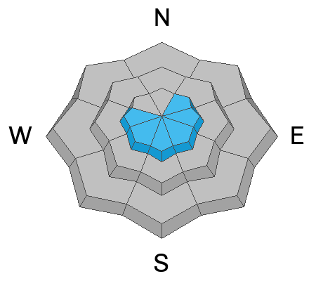
The good news... it feels like the snowpack is getting comfortable in its own skin and attempting to reach a point of equilibrium... not healing, but grasping for balance at the moment. And to me, this means the chances of triggering a deep, dangerous avalanche continue decreasing, but the consequences remain severe. Suspect terrain I'm steering clear of are steep, rocky slopes, especially where the pack is slightly thinner. Likey trigger points are near bushes or rocks, where I could collapse the slope and knock the legs out from underneath the snow above me.
Avalanche Problem #2
Wind Drifted Snow
Type
Location
Likelihood
Size
Description
A few inches of light, fluffy storm snow helps camouflage the canvas and that, of course, complicates the picture in identifying where today's wind drifts are located. I think this is a very manageable and straight-forward avalanche problem. But as a reminder, you know the drill... lose the wind and we lose the problem. Simply seek out wind sheltered, mid and lower elevation terrain and you'll score a great day of riding.
General Announcements
The Uinta weather station network was upgraded this summer and all that real-time info is found here. Simply click on the "Western Uinta" tab and then the "Weather Stations" tab to find all your weather needs.
We are always looking for snow and avalanche observations or just general riding conditions. So... if you see something, say something. You can reach our team directly by contacting: Craig at craig@utahavalanchecenter.org, 801-231-2170, or Andrew at andy@utahavalanchecenter.org, or 860-460-8142.
General Information
This forecast is from the U.S.D.A. Forest Service, which is solely responsible for its content. This forecast describes general avalanche conditions and local variations always occur. This forecast was issued on Sunday, January 19th at 04:00AM and expires 24 hours after it was issued. We will update the forecast by 0700 AM tomorrow. But, in the meantime reach out to us with questions, or if you see anything in your travels.