Join us at our 2nd Annual Blizzard Ball

Forecast for the Uintas Area Mountains

Andrew Nassetta
Issued by Andrew Nassetta on
Monday morning, January 20, 2025
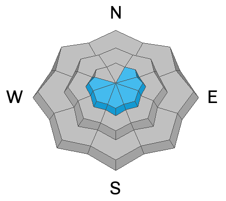
For today, MODERATE danger exists on mid and upper-elevation terrain on the north half of the compass on steep, wind-drifted slopes. Although isolated, it is still POSSIBLE to trigger a slab avalanche on sugary, faceted snow that may break deeper and wider than we might expect and is big enough to bury or kill us.
LOW danger exists at all other aspects and elevations, and good riding is matched with reduced avalanche hazard in protected, lower angle slopes out of the wind-zone.
Low
Moderate
Considerable
High
Extreme
Learn how to read the forecast here
Special Announcements
  • Please join UAC Forecaster Craig Gordon, Tuesday January 21st from 6:00-7:30 PM at Alpha Coffee in Cottonwood Heights for a FREE, State of the Snowpack presentation. Reserve a spot and find out more deets here.
  • In addition, please join the UAC at Deer Valley on January 30th for the 2nd Annual Blizzard Ball Gala. The night will be full of fun including delicious cuisine, live music, an auction, and presentation by Bruce Tremper. More info found here.
Weather and Snow
Nowcast
Skies are clear, delivering the coldest day of the season as trailhead temperatures hover around -10℉. Northerly winds blow in the 20's and 30's helping shoot temps down towards -40℉ with windchill up on the high peaks -- And no, unfortunately that is not a typo.
Forecast
The cold persists with an expected daytime high of 5℉ and continued wind from the north around 10-20 MPH. Be prepared and stay covered up today, as cold temperatures are the greatest hazard.
Futurecast
Things continue to stay cold, calm and clear as we move through the holiday and into the working week.
Recent Avalanches
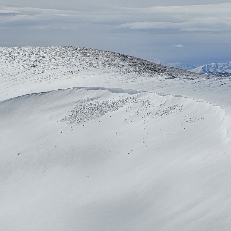
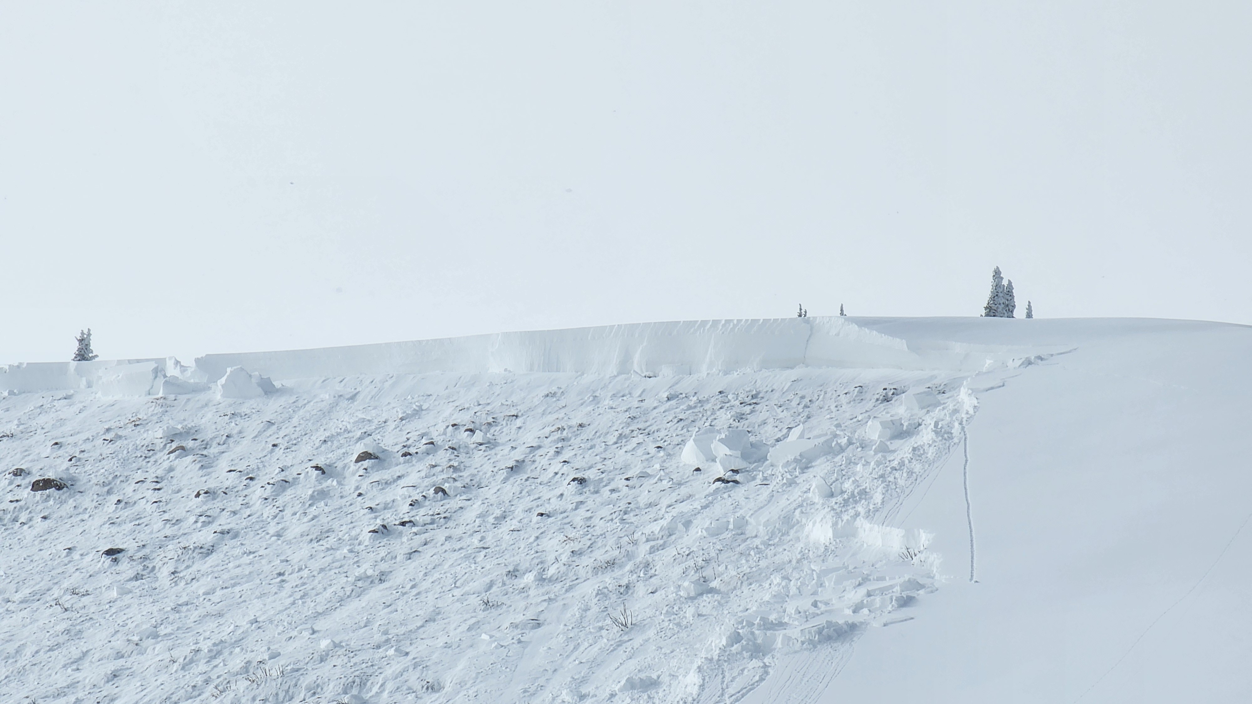
Yesterday, we saw no news of the weird and the forecast was spot on. In fact we observed a wind-drifted slope that avalanched naturally near Strawberry Reservoir within the newly fallen snow. A manageable avalanche nonetheless until you trigger it in consequential terrain, like above rocks, cliffs or deep gullies.
You can find trip reports and recent slides from across the range and beyond, here.
Ad
Avalanche Problem #1
Persistent Weak Layer
Type
Location
Likelihood
Size
Description
The last reported avalanche on a PWL was about a week ago on Sunday, January 12th. Good news is the snowpack has slowly gotten comfortable in its current state, the bad news is there is still a chance of triggering a rugged, slab avalanche a 2-4 feet deep and up to a few hundred feet wide. The likelihood of us triggering a nasty avalanche has gone down significantly over the past few weeks, but if you do, the consequences remain severe. My move is avoidance, and I am steering clear of suspect terrain and specific slopes that are steep, rocky, and wind-effected where the pack is slightly thinner. I am avoiding likely trigger points that live near bushes, rocks, steep rollovers and anywhere the snowpack is thin and most stressed.
Avalanche Problem #2
Wind Drifted Snow
Type
Location
Likelihood
Size
Description
Sustained moderate winds around 20 MPH have created stiff drifts in the wind-zone. Specific to upper elevations ridgelines and terrain features, today's hard slabs will allow you to get out on slope before breaking above or below you and may feel solid under our sled. It is a very manageable and straight-forward avalanche problem with proper terrain choices and travel techniques. Look for clean slopes without cliffs, rocks, or terrain traps and travel mindfully and expose one person to the avalanche hazard at a time.
General Announcements
The Uinta weather station network was upgraded this summer and all that real-time info is found here. Simply click on the "Western Uinta" tab and then the "Weather Stations" tab to find all your weather needs.
We are always looking for snow and avalanche observations or just general riding conditions. So... if you see something, say something. You can reach our team directly by contacting: Craig at craig@utahavalanchecenter.org, 801-231-2170, or Andrew at andy@utahavalanchecenter.org, or 860-460-8142.
General Information
This forecast is from the U.S.D.A. Forest Service, which is solely responsible for its content. This forecast describes general avalanche conditions and local variations always occur. This forecast was issued on Monday, January 20th at 06:00AM and expires 24 hours after it was issued. We will update the forecast by 0700 AM tomorrow. But, in the meantime reach out to us with questions, or if you see anything in your travels.