Forecast for the Moab Area Mountains

Eric Trenbeath
Issued by Eric Trenbeath on
Friday morning, December 20, 2024
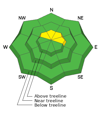
Most terrain has generally LOW danger. Dry-loose avalanches or sluffs may run on steep, northerly aspects.
A very isolated, or MODERATE danger remains on steep slopes above treeline that face NW-N-NE-E. Human-triggered avalanches failing on a persistent weak layer are possible. Areas of concern include steep convexities, cliff bands, and shallow rocky areas.

Conditions remain thin and rocks, stumps, and dead fall still pose a significant hazard.
Low
Moderate
Considerable
High
Extreme
Learn how to read the forecast here
Special Announcements
Geyser Pass Road: The road is plowed to the trailhead. Surface is dirt down low, snowpacked and icy above. AWD with good tires recommended.
Grooming Conditions: Surfaces are currently packed solid from weeks of ski and snowmobile traffic. We really need some fresh snow to start grooming.
Now is a great time to dial in your safety gear including putting fresh new batteries in your beacons! Local shops across the state will be handing out free Batteries for Beacons now until February 1, 2025. All you need to do is fill out a quick survey and grab the AAA or AA batteries you need to keep your beacon fresh this season. Head into Moab Gear Trader to get yours!
Weather and Snow
6 A.M. Snow and Weather Data
24 Hour Snow: 0" 72 Hour Snow: 0" Season Total Snow: 46" Depth at Gold Basin: 23"
Winds on Pre-Laurel Peak: SW 5-10 Temp: 27° F Percent of Normal (SWE): 115%
Weather
Stop me if you've heard this before. Today, look for sunny skies, mostly light westerly winds, and high temps soaring into the mid to upper 30's. Expect more of the same for the next few days. A storm is still slated for Christmas.
General Conditions
It's officially pretty rugged out there. Above treeline, winds have hammered the snow surface and created a landscape of shallow, but hardened wind board. Near treeline and below, the snowpack is weakening and losing cohesion. Loose sluffs may run on the steepest slopes at these elevations. There are still some areas where the dense, November slab remains intact but supportable conditions are dwindling.
For more details see this observation from Dave Garcai and this observation from Maggie Neilsen.
Snowpack and Weather Data
Gold Basin SNOTEL site (10,000')
SNOTEL site near Geyser Pass Winter Trailhead (9600')
Wind Station on Pre-Laurel Peak (11,400')
NWS forecast for the La Sal Mountains.
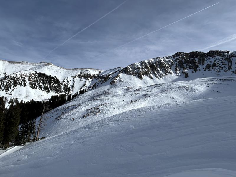
Alpine terrain is a mix of scoured surfaces and old, hard wind crusts. I'm looking for quality turns elsewhere.
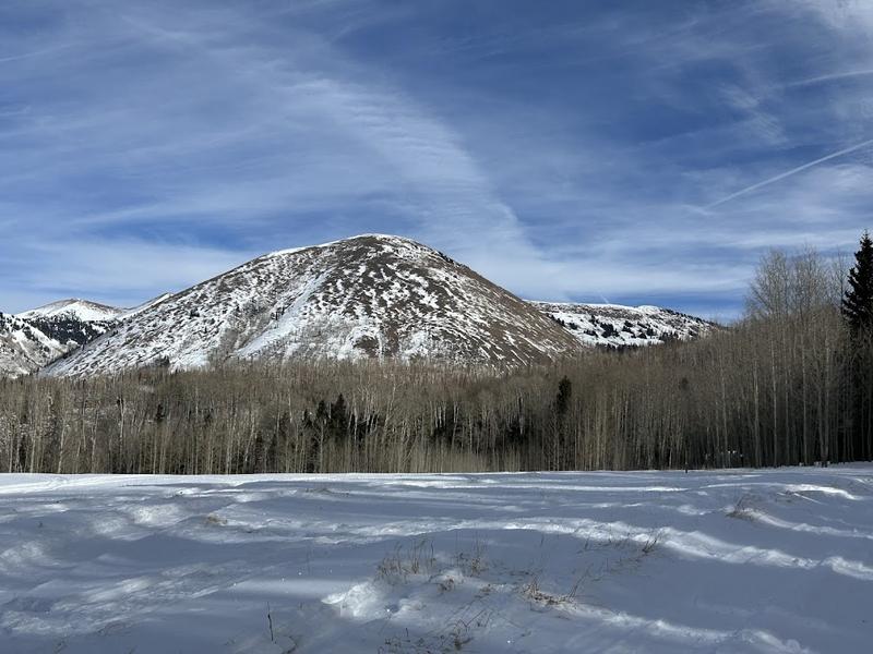
South faces are looking pretty thin. Maggy Nielsen photo.
Recent Avalanches
Ad
Avalanche Problem #1
Persistent Weak Layer
Type
Location
Likelihood
Size
Description
Poor snowpack structure, comprised of a dense slab over weak, faceted snow still exists in some areas. In specific areas above treeline, the slab is cohesive enough to produce avalanches. The problem with basal facets is that even though it has been a long time since our last avalanche, you can still get surprised. All you need to do is find a trigger point. This is why we have a hard time trusting this setup. While the likelihood has decreased, human-triggered avalanches may still be possible. If triggered, these D2 avalanches will break to the ground, en-training the full depth of the snowpack. Likely trigger points include rocky, radical terrain, steep convexities, cliff bands, and shallow slope margins.
On some near treeline slopes, and many slopes below, the slab has faceted through and has lost all cohesion. This is where you will find the softest snow right now but obstacles are not far below the surface. Looking ahead, this loose, cohesion-less snow will undoubtedly form our next persistent weak layer when snow finally comes.
Additional Information
Sign up for text alerts to get the most up to date information about changing conditions, road plowing, special avalanche announcements.
Follow us on Instagram @utavy_moab
General Announcements
This forecast is from the U.S.D.A. Forest Service, which is solely responsible for its content. This forecast describes general avalanche conditions and local variations always occur.