Forecast for the Moab Area Mountains

Issued by Eric Trenbeath on
Saturday morning, December 21, 2024
Saturday morning, December 21, 2024
Most terrain has generally LOW danger. Although unlikely, isolated areas remain on steep, northerly aspects above treeline where it may be possible to trigger an avalanche. Minimize your risk by avoiding areas of rocky, radical, extreme terrain. Continue to practice safe travel techniques and cross suspect slopes one at a time. Be mindful of steep convexities or blind break-overs, and avoid areas that sound or feel hollow underneath.
Loose snow sluffing may be possible on steep northerly aspects near treeline and below where the snowpack is weakening and losing cohesion.
Conditions remain thin and rocks, stumps, and dead fall still pose a significant hazard.
Conditions remain thin and rocks, stumps, and dead fall still pose a significant hazard.

Low
Moderate
Considerable
High
Extreme
Learn how to read the forecast here
 Special Announcements
Geyser Pass Road: The road is plowed to the trailhead. Surface is dirt down low, snowpacked and icy above. AWD with good tires recommended.
Grooming Conditions: Surfaces are currently packed solid from weeks of ski and snowmobile traffic. We really need some fresh snow to start grooming.
Now is a great time to dial in your safety gear including putting fresh new batteries in your beacons! Local shops across the state will be handing out free Batteries for Beacons now until February 1, 2025. All you need to do is fill out a quick survey and grab the AAA or AA batteries you need to keep your beacon fresh this season. Head into Moab Gear Trader to get yours!
 Weather and Snow
6 A.M. Snow and Weather Data
24 Hour Snow: 0" 72 Hour Snow: 0" Season Total Snow: 46" Depth at Gold Basin: 23"
Winds on Pre-Laurel Peak: SW 0-5 Temp: 27° F Percent of Normal (SWE): 115%
Weather
Look for continued warm and sunny conditions through the weekend. A small disturbance will bring clouds and a slight chance of snow on Monday. Another storm moves through on Wednesday but I'm afraid it really is going to take a Christmas miracle for it to amount to much. An unsettled pattern continues. Stay tuned.
General Conditions
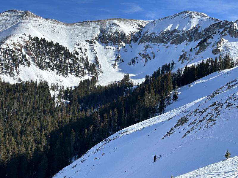
Dave Garcia and I got out and toured the alpine yesterday and conditions are pretty rugged. Above treeline, winds have hammered the snow surface and created a landscape of alternating crusts and hardened wind board. Near treeline and below, the snowpack is weakening and losing cohesion. Loose sluffs may run on the steepest slopes at these elevations. There are still some areas where the dense, November slab remains intact, but supportable conditions are dwindling.

We poked around in the snow above treeline and found a mostly faceted snowpack. There are areas where a denser slab overlies weaker snow, but the slab itself is deteriorating, and stability tests continue to be non-reactive. Isolated, hard slabs of wind drifted snow overlying weak, faceted, sugary snow can be found up there in some areas. Although these slabs are extremely stubborn to release, this is the setup that would be the most likely to cause problems. Minimize your risk by continuing to avoid steep, convex slopes, especially those that have a smooth rounded appearance, or that sound or feel hollow underneath.
Snowpack and Weather Data
Gold Basin Storm Stake (10,000')
Gold Basin SNOTEL site (10,000')
Wind Station on Pre-Laurel Peak (11,400')
 Recent Avalanches
Avalanche Problem #1
Persistent Weak Layer
Type
Location

Likelihood
Size
Description
It's now been more than three weeks since our last storm/avalanche event, and the likelihood of triggering a persistent slab avalanche is low. Nevertheless, poor snowpack structure, comprised of a dense slab over weak, faceted snow still exists in some areas above treeline and although unlikely, triggering an avalanche is not impossible. For the most part, poor snow conditions will prevent you from even wanting to be in areas where this structure exists, but you should still keep it in mind as you move through the mountains.
On many northerly aspects near treeline and below, the slab has faceted through and has lost all cohesion. This is where you will find the softest snow right now but obstacles are not far below the surface. You may also encounter loose snow sluffs in these areas. Looking ahead, this loose, cohesion-less snow will undoubtedly form our next persistent weak layer when snow finally comes.
Additional Information
Sign up for text alerts to get the most up to date information about changing conditions, road plowing, special avalanche announcements.
Follow us on Instagram @utavy_moab
General Announcements
This forecast is from the U.S.D.A. Forest Service, which is solely responsible for its content. This forecast describes general avalanche conditions and local variations always occur.


