Forecast for the Moab Area Mountains

Eric Trenbeath
Issued by Eric Trenbeath on
Sunday morning, December 8, 2024
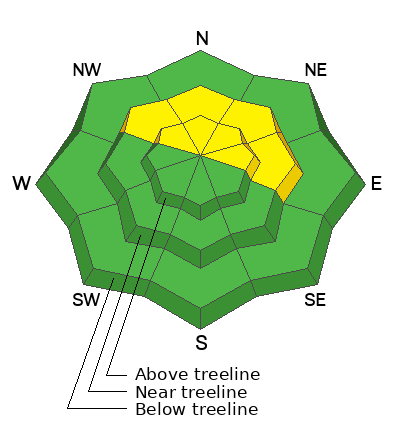
A MODERATE avalanche danger exists on steep slopes near and above treeline that face NW-N-E and human-triggered avalanches failing on a persistent weak layer remain POSSIBLE.
The avalanche danger is mostly LOW on all other aspects. Small avalanches on isolated terrain features are possible.

Conditions remain thin and rocks, stumps, and dead fall still pose a significant hazard.
Low
Moderate
Considerable
High
Extreme
Learn how to read the forecast here
Special Announcements
Saturday, December 14 - 3rd Annual UAC Moab/LUNA Winter Kickoff Party, 6 PM at the MARC. Information and tickets available here.
Geyser Pass Road: The La Sal Loop Road will be closed above Pack Creek Monday-Friday from 8:30 to 5:30 for construction through December 18. Access to the Geyser Pass Winter Trailhead will be from Castle Valley or Sand Flats Road during these hours. Click here for more information.
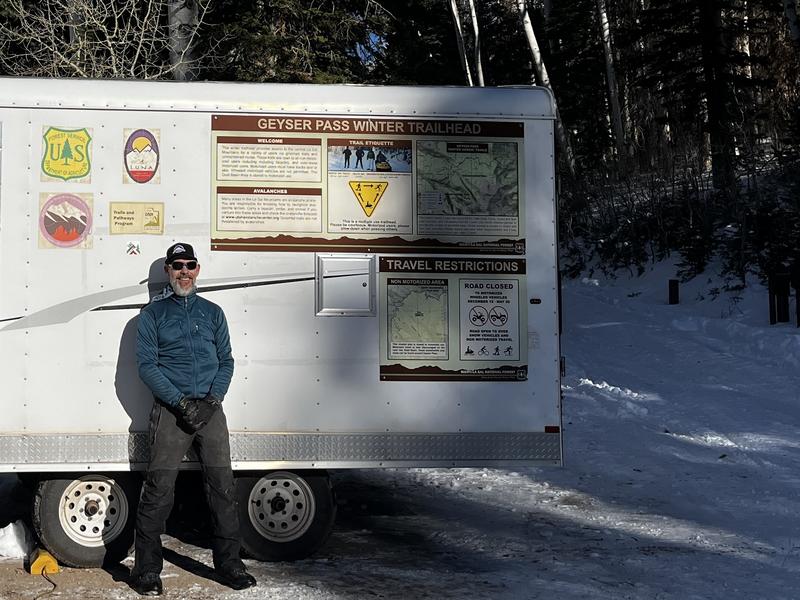
The grooming equipment has arrived at the Geyser Pass Winter Trailhead! Grooming will commence after December 15 when the road above the trailhead is officially closed to wheeled vehicles.
Weather and Snow
6 A.M. Snow and Weather Data
24 Hour Snow: 0" 72 Hour Snow: 0" Season Total Snow: 44" Depth at Gold Basin: 24"
Winds on Pre-Laurel Peak: WNW 10-15 mph Temp: 25° F Percent of Normal (SWE): 184%
Weather
Today, look for high clouds and increasing westerly winds ahead of an upper level, low-pressure trough descending from the north. High temps will again climb up to the mid 30's at 10,000', which is about 5-10 degrees above average. The passage of the cold front this evening will cause temps to crater, and tomorrow will be cold, cloudy, and blustery with a slight chance for snow. Dry weather and warmer temps return on Tuesday.
General Conditions
It's been very warm in the mountains the last few days with high temperatures reaching the mid to upper 30's at 10,000'. The snow surface on shady aspects remains loose and dry, and it's growing weaker by the day as it recrystallizes into near surface facets. There's also a fair bit of surface hoar about. These surfaces will undoubtedly become future weak layers but for now they make for good turning and riding. In his travels yesterday, Dave Garcia reported finding "pseudo-corn snow" on southerly aspects that was fun to ski although south facing slopes are getting thin and some are bare. All things considered, conditions are holding up pretty well. The weather is beautiful, travel is fast and easy, and the likelihood of triggering an avalanche is diminishing with each passing day.
Snowpack and Weather Data
Gold Basin SNOTEL site (10,000')
SNOTEL site near Geyser Pass Winter Trailhead (9600')
Wind Station on Pre-Laurel Peak (11,400')
NWS forecast for the La Sal Mountains.
It looks pretty nice out! Dave Garcia photo.
Recent Avalanches
The list of known avalanches from the Nov 27 cycle is growing. See the avalanche database here.
Ad
Avalanche Problem #1
Persistent Weak Layer
Type
Location
Likelihood
Size
Description
Poor snowpack structure remains with a dense, cohesive slab over top of weak, faceted snow, but time and warm daytime temperatures have helped to stabilize the snowpack. Areas where you could still trigger an avalanche are on steep slopes near and above treeline that face NW-N-E. If you decide to step out into this kind of terrain, choose planar slopes without complex terrain features. Avoid likely trigger points such as steep convexities, or shallow points along slope margins or near rock outcrops.
Outlying problem areas may still exist on upper elevation slopes facing W and SE. Most of these slopes have thin cover, but deeper pockets exist along leeward terrain features and these areas still warrant caution. For more on this, see Dave Garcia's observation.
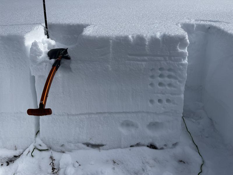
Photo illustrates the poor structure that still exists. This test below treeline on a west aspect produced no results. I found similar results and a similar snowpack on north and northeast aspects below treeline.
Additional Information
Sign up for text alerts to get the most up to date information about changing conditions, road plowing, special avalanche announcements.
Follow us on Instagram @utavy_moab
General Announcements
This forecast is from the U.S.D.A. Forest Service, which is solely responsible for its content. This forecast describes general avalanche conditions and local variations always occur.