Check out our Holiday Auction

Forecast for the Provo Area Mountains

Drew Hardesty
Issued by Drew Hardesty on
Tuesday morning, December 3, 2024
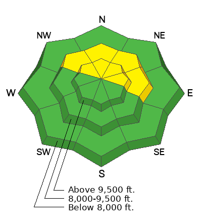
The avalanche danger is MODERATE on steep mid and upper elevation northerly to easterly facing slopes. Human triggered avalanches 1-3' deep remain possible. Caution is warranted in the high alpine terrain.
With direct sun and rapidly warming temperatures, wet loose avalanches should also be on your radar on all steep sunlit slopes today.
Low
Moderate
Considerable
High
Extreme
Learn how to read the forecast here
Special Announcements
The 17th Annual Utah Snow and Avalanche Workshop (USAW) is scheduled for Saturday, December 7th. Information and tickets are available here.
Weather and Snow
Skies are mostly clear with light winds. Temperatures are inverted this morning, with temps in the upper 30s to low 40s up high, the low 20s down low. A ridge of high pressure is parked stubbornly overhead, keeping us in the doldrums of day to day sunny skies with storms well to the north of us.
For today, we'll see continued sun, light winds from the west and temps soaring into the upper 40s down low, the mid-30s up high. Currently there's only 1-3' of snow on the ground with soft turns interspersed with sun and wind damaged snow.
The weather models hint at a storm late weekend but we'll see.
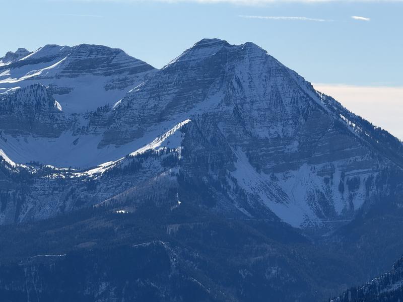
Coverage on the north side of Timp below (Meisenheimer photo)
Recent Avalanches
Many large natural slab avalanches ran with the storm last Tuesday with a few trickling in the days after that. None - as far as we know - were human triggered. The list is HERE. These slides were 1-3' deep and a few hundred feet wide on steep north to east facing slopes and primarily noted along the Cascade ridgeline in the south fork of Provo Canyon.
Ad
Avalanche Problem #1
Persistent Weak Layer
Type
Location
Likelihood
Size
Description
A poor snowpack structure exists in the shady terrain of the mid and upper elevations. Here, you'll find 1-2' of recent storm snow over about a foot of early season weak sugary faceted snow. In our travels in the south fork on Sunday, we experienced no cracking or collapsing and snow tests were inconsistent at best. Still, persistent weak layers of faceted grains are notoriously tricky and caution is warranted in steep terrain.
Bo Torrey, John Woodruff and I traveled to Big Springs to examine the snowpack and avalanche cycle after the recent storm. Our observation can be found HERE. Trent Meisenheimer traveled from Tibble Fork to Silver Lake and up to Major Evans and found generally stable snow with a poor snowpack structure. You can find his observation HERE.
Video: Showing the slab over a weak layer propagate a crack with an extended column test. Big Springs, Provo.
General Announcements
This information does not apply to developed ski areas or highways where avalanche control is normally done. This forecast is from the U.S.D.A. Forest Service, which is solely responsible for its content. This forecast describes general avalanche conditions and local variations always occur.