Join us at our 2nd Annual Blizzard Ball

Forecast for the Provo Area Mountains

Trent Meisenheimer
Issued by Trent Meisenheimer on
Monday morning, December 2, 2024
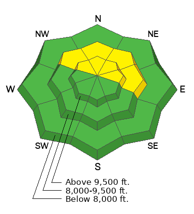
The avalanche danger is MODERATE on mid and upper-elevation slopes facing northwest through east and upper-elevation slopes facing southeast and west. In this terrain, human-triggered avalanches failing on a Persistent Weak Layer 1-2 feet deep and up to 100 feet wide are possible. The most suspect slopes will be ones loaded by the wind.

Heads up: Extra caution is advised in the mountains south of Provo Canyon Road (Hwy 189), which includes Cascade and Provo Peak environs. Here, we saw large and destructive avalanches last week, as we think this half of the range revived the loin's share of wind and water weight.
Low
Moderate
Considerable
High
Extreme
Learn how to read the forecast here
Special Announcements
The 17th Annual Utah Snow and Avalanche Workshop (USAW) is scheduled for Saturday, December 7th. Information and tickets are available here.
Weather and Snow
Under clear skies, the temperature inversion is strong in Provo, with Aspen Grove (6,880') at 19°F and Cascade Peak (10,800') at F. The wind has veered from the northwest to the northeast and now blows 10-15 mph with gusts into the low 20s at Arrowhead Summit. However, at 11,000', the wind is calm.
Today, we expect clear and sunny weather, with temperatures rising into the mid-40s at about 8,800'. The wind will continue to blow from the northeast at speeds of 5-15 mph.
It's been five nights of clear skies and cold temperatures. The Diurnal cycle (day to night) is taking its toll on our snow surface. Temperature changes and the energy balance of incoming shortwave radiation and longwave outward radiation are causing our adolescent snowpack to deteriorate, becoming weaker and weaker and more faceted every day. The good news is that the riding and turning conditions are pretty good. The bad news is that we are developing a nasty weak layer that will haunt us in the future.
I looked for a storm in fairy tale land (six days out on the GFS) and saw one around Sunday, December 8th. Until then, like a ship stuck at sea with no wind, we are in the doldrums of high pressure.
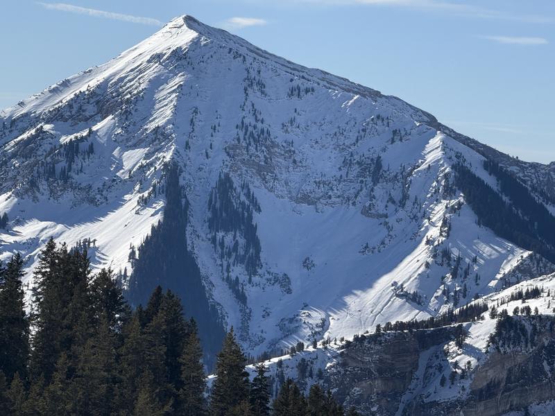
Photo looking at the coverage on Box Elder Peak.
Recent Avalanches
Drew Hardesty, Bo Torry, and John Woodruff traveled to Big Springs to examine the snowpack and avalanche cycle after the recent storm. Their observations can be found HERE. I traveled from Tibble Fork to Silver Lake and up to Major Evans and found generally stable snow with a poor snowpack structure. You can find my observation HERE.
Ad
Avalanche Problem #1
Persistent Weak Layer
Type
Location
Likelihood
Size
Description
On mid and upper-elevation slopes facing northwest through east and upper-elevation southeast and west, you'll find a poor snowpack structure where stronger snow (slab) is over weaker (faceted) snow. Here, it remains possible for a human to trigger a slab avalanche that fails 1-2 feet deep and up to 100 feet wide.
Video: Showing the slab over a weak layer propagate a crack with an extended column test. Big Springs, Provo.
General Announcements
This information does not apply to developed ski areas or highways where avalanche control is normally done. This forecast is from the U.S.D.A. Forest Service, which is solely responsible for its content. This forecast describes general avalanche conditions and local variations always occur.