Check out our Holiday Auction - Sign Up for the Utah Snow and Avalanche Workshop (USAW)

Forecast for the Uintas Area Mountains

Craig Gordon
Issued by Craig Gordon on
Friday morning, March 1, 2024
As a powerful winter storm evolves, expect the avy danger to ramp up over the weekend-
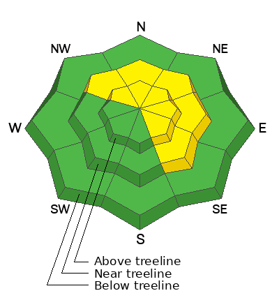
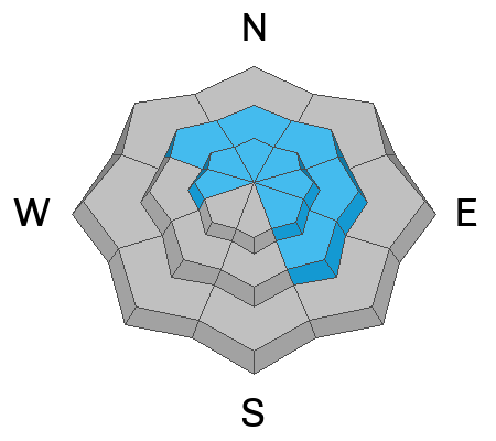
For today, MODERATE avalanche danger is found at and above treeline. Human triggered avalanches are POSSIBLE on steep, shady slopes, especially in the wind-zone where you'll encounter fresh drifts reactive to our additional weight. Becoming more the exception than the rule, we can still trigger a deep, dangerous slide that breaks to the ground in steep, rocky terrain facing the north half of the compass.
Most lower elevation shady terrain and slopes facing the south half of the compass offer LOW avalanche danger and human triggered slides are UNLIKELY.

Low
Moderate
Considerable
High
Extreme
Learn how to read the forecast here
Special Announcements
We are seeking a passionate individual to join us as Executive Director of the nonprofit Utah Avalanche Center. Click here for more information.
Weather and Snow
Nowcast- Yesterday, southerly winds began cranking into the 40's and 50's right around suppertime, taking full advantage of the additional 24 hours of a leap year, and continue in that spirit this morning. Meanwhile, temperatures are rather mild, registering in the mid 20's and low 30's. Our mid week storm snow is getting worked, but swaths of soft, settled snow are still found on wind sheltered, north facing slopes.
Forecast- The Lion of Zion ushers in March with a complex tempest. Yes a big storm is on the way... yes it's going to dump.... and yes it's gonna be windy. In fact, today's southerly winds tap into a grungy Bob Dylan persona (the Rolling Thunder Review era), delivering Idiot Wind... blowing like a circle around my skull... from the Grand Coulee Dam to the capitol. With a dynamic storm churning away, expect southerly winds nuking into the 70's along the ridges with occasional light snow throughout the day. Temperatures climb into the the upper 30's and dip to near freezing overnight.
Futurecast- A solid looking, yet rather complex storm sets its sights on the Uinta region for Saturday. The cold front plugs into a stack of Marshall's and blasts through northern Utah late Saturday afternoon. Temperatures crash and heavy snow develops. Expect a couple inch an hour snowfall to linger into early Sunday morning.
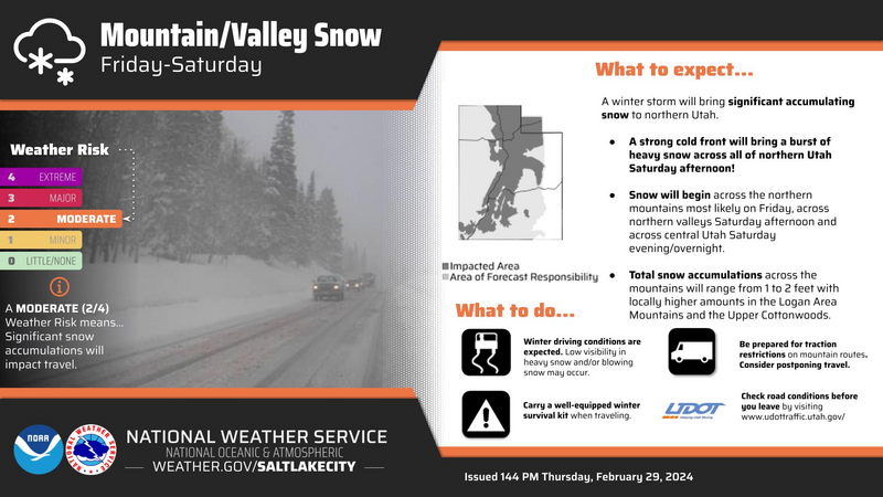
Our good friends and longtime partners at Salt Lake's National Weather Service issued a Winter Storm Warning for the Uinta zone

SNOTEL sites in the Uintas, and much are Utah, report snow water equivalent amounts of 104%-146% of the 30 year median.
Recent Avalanches
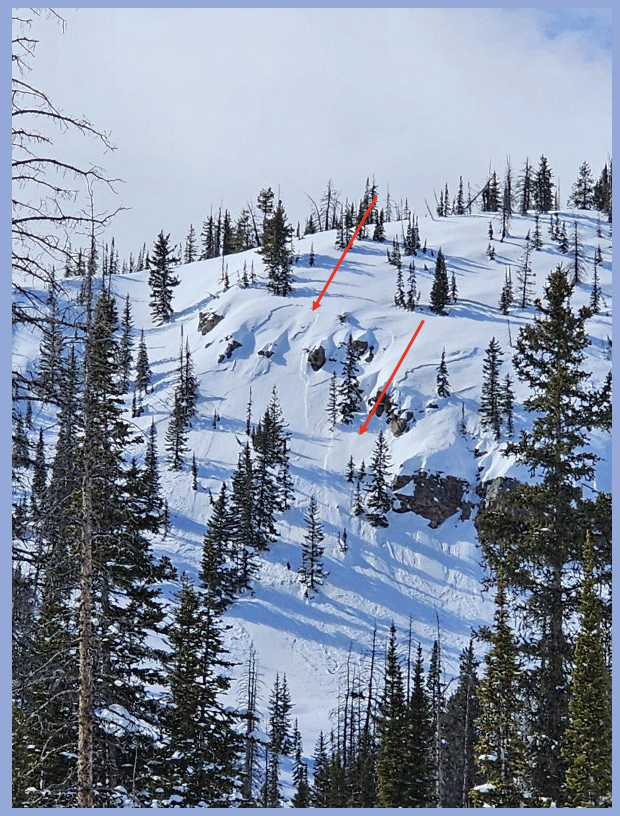
Reported from the Duchesne Ridge yesterday, this remotely triggered slide (from a distance), most likely failed on faceted snow near a heat crust buried by Tuesday's storm snow. A big red flag, especially with more snow, water, and wind on tap.
In addition, avy-savvy, snowpro Joey Manship found a similar, yet not as well connected, piece of snow near Castle Peak yesterday.
For all Uinta observations and recent avalanche activity click HERE.
Ad
Avalanche Problem #1
Persistent Weak Layer
Type
Location
Likelihood
Size
Description
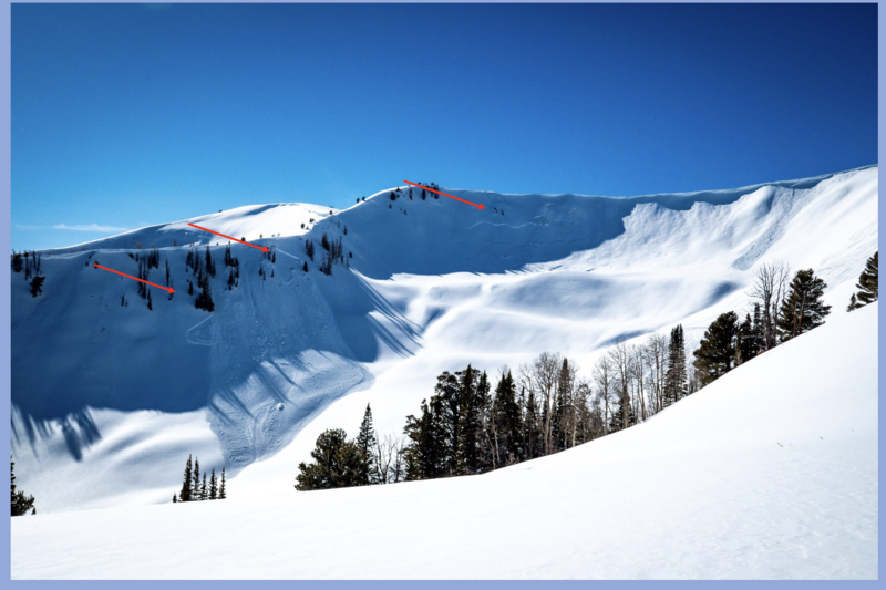
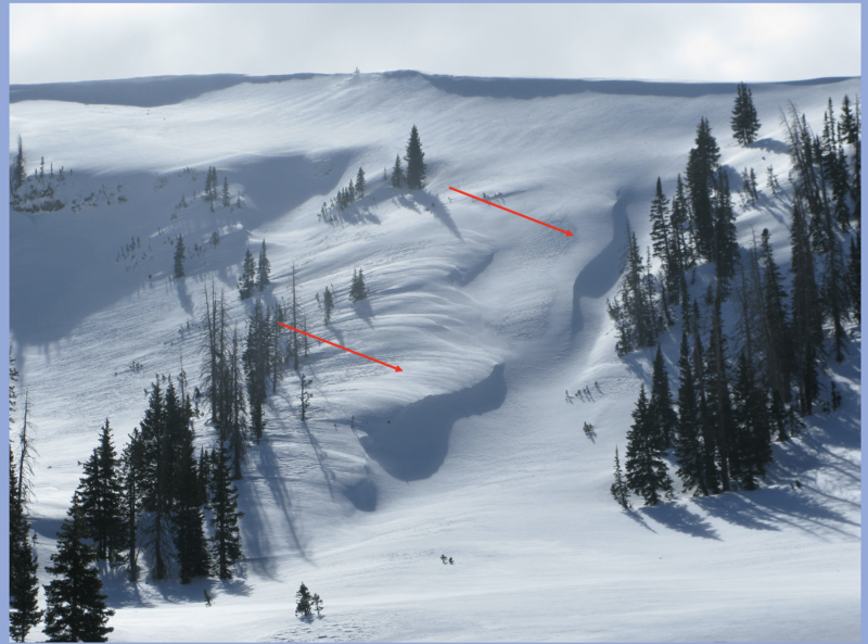
A repeater avalanche path in Weber Canyon, this east facing slope in the alpine came to life with Tuesday's snow and wind, delivering several avalanches that broke close to the ground in steep, rocky terrain.
Daily avalanche forecasts are a history of the snowpack, often reading like a novel, with a vast array of personalities, scenes, and of course, a cast characters. And much like a page taken from the book, occasionally one of the leading roles is stripped from the story line. And so it is with the Valentines crust/NSF combo which, over time, has grown relatively dormant, hasn't produced an avalanche in over a week, and the screenwriters put it on the back burner for awhile. Mark explains his research here.
Now back to our regularly scheduled programming where much of our terrain offers a deep and relatively strong snowpack and triggering a monster slide that breaks to weak layers now buried deeply in our snowpack is unlikely. Ted and I found a bomber pack yesterday in Upper Chalk Creek. However, slopes that have remained thin and weak this season are likely suspects and need to be avoided. Terrain that has avalanched multiple times and slopes that have been stripped by strong winds fit into this category. Avoiding this deep, dangerous avalanche dragon is the ticket, but ya gotta do your homework and identity terrain with shallow snow.
Note to self-
Steep, rocky zones are likely trigger points because they offer a much thinner snowpack where we can effect the weak snow.
Avalanche Problem #2
Wind Drifted Snow
Type
Location
Likelihood
Size
Description
Recent strong winds blew from nearly every direction, whipping up drifts on leeward slopes and cross loading terrain features like chutes and gullies.
Winds are all over the map, drifting snow in unusual locations and lower down-slope than we expect to see. Stomping around yesterday, it felt like most of the drifting issues settled out, were welded in place, or just plain unreactive. However, I'm still steering clear of fat rounded pieces of snow, especially if they sound hollow like a drum.
Additional Information
The Uinta weather station network was upgraded this summer and all that real-time info is found HERE. Simply click on "western Uinta" tab and then "weather stations" tab.

We are always looking for snow and avalanche observations or just general riding conditions. So... if you see something, say something. You can reach me directly at craig@utahavalanchecenter.org or 801-231-2170.
Also, if you're looking for more avy education opportunities for yourself, your crew, or your club please don't hesitate to reach out to me and we'll find a presentation, class, or clinic for ya!
General Announcements

Issued at 0400 on Friday, March 1st this forecast will be updated by 0700 Saturday, March 2nd, 2024.
This forecast is from the U.S.D.A. Forest Service, which is solely responsible for its content. This forecast describes general avalanche conditions and local variations always occur.