Forecast for the Uintas Area Mountains

Issued by Craig Gordon on
Saturday morning, March 2, 2024
Saturday morning, March 2, 2024
An extremely rowdy storm churns away and should land into the Uinta zone midday... the avy danger quickly ramps up once the storm settles in-
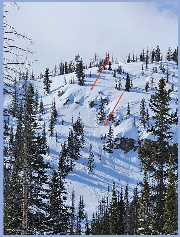
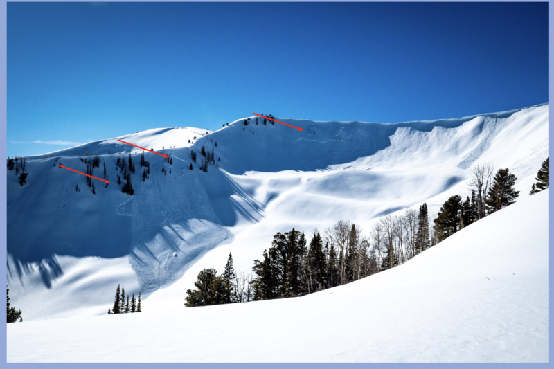
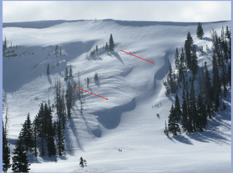
In meteoric fashion, I expect the avalanche danger rises from MODERATE to CONSIDERABLE with the rapid onset of snow, water, and continued wind. Once the storm settles in, both human triggered and natural avalanches are LIKELY on steep, mid and upper elevation, wind drifted slopes. Becoming more the exception than the rule, we can still trigger a deep, dangerous slide that breaks to the ground in steep, rocky terrain facing the north half of the compass.
Even lower elevation slopes come to life with fresh drifts and rapidly accumulating snow. Anticipate the avalanche danger rising to MODERATE around our trailheads with human triggered avalanches POSSIBLE this afternoon.

Low
Moderate
Considerable
High
Extreme
Learn how to read the forecast here