Current Conditions: Wednesday turned into a spectacular day in the mountains with sun filtering through thin high clouds. Temperatures briefly made it into the upper 20s and have dropped back to around 20˚F. Wind has been from the southwest with light to moderate speeds. Riding conditions remain top notch. South and southwest facing slopes became slightly damp from the sun on Wednesday and you may find a melt/freeze crust.
Mountain Weather: We'll have cloudy skies today with the chance for snowfall late this afternoon. Temperatures will be in the low to mid 20s and wind will be from the southwest with moderate speeds possibly increasing a bit later on. A storm moves through tonight and into Friday which should bring 4 to 8 inches of new snow.
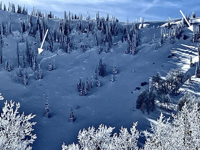
No new recent avalanches have been observed or reported but during the clearing on Wednesday, there was visual evidence of a natural avalanche cycle from the last storm. I would describe the avalanches as "pockety" in that they were not cracking out wide across entire avalanche paths. There is no doubt that they were breaking deep into the old facets from November. There was snow on top of the fracture lines and debris which tells me the cycle occurred sometime Saturday or Sunday. PHOTO: Brett Kobernik, South Fork, Spring City Canyon