Forecast for the Skyline Area Mountains

Brett Kobernik
Issued by Brett Kobernik on
Friday morning, January 6, 2023
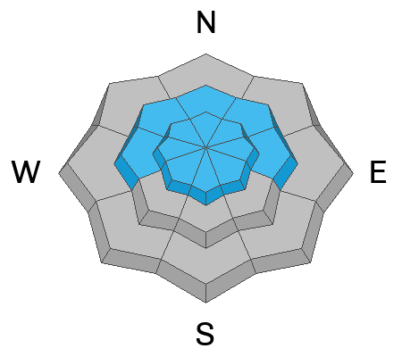
The overall avalanche danger is rated CONSIDERABLE today.
The chances for human triggered avalanches are becoming less but if you trigger one, it's going to be deep and nasty.
Continue to avoid the steeper slopes especially on the north half of the compass in the upper elevations.
Low
Moderate
Considerable
High
Extreme
Learn how to read the forecast here
Weather and Snow
Current Conditions: Moderate steady wind from the southeast on Wednesday drifted a bit of snow and stiffened up the snow surface a bunch in exposed terrain. No matter, we have a little fresh dusting this morning. 6 to 8 inches of new snow fell overnight. Once again, the northern Skyline received the most new snow. Overnight temperatures were in the low 20s and the wind is light and from the west southwest.
Mountain Weather: We'll see snowfall starting to taper off later this morning with a few more inches possible. The wind will be from the west and should remain pretty light. Temperatures should stay in the low 20s. The weekend looks pretty nice with partly cloudy skies and temperatures in the low to mid 20s. There's another chance for light snow accumulation Sunday night.
Ad
Avalanche Problem #1
Persistent Weak Layer
Type
Location
Likelihood
Size
Description
The Persistent Weak Layer from November remains the biggest threat. Chances for triggering an avalanche that breaks into that layer are becoming less as time goes on. The mid portion of the snowpack is getting incredibly strong due to the large storm last week that contained very high density snow. This is "bridging" the deeper buried weak layer making it harder to trigger. What I don't like is that sometimes bridges fail. The deeply buried weak layer is still producing poor stability test results. It remains relatively loose and weak. I want to see it gain some more strength before I'm comfortable that it won't fail anymore. We are going in a good direction especially considering we continue to get more snow which will continue to compact that weak layer into a stronger layer eventually.
General Announcements
This forecast is from the U.S.D.A. Forest Service, which is solely responsible for its content. This forecast describes general avalanche conditions and local variations always occur.