Check out our Holiday Auction

Forecast for the Logan Area Mountains

Toby Weed
Issued by Toby Weed on
Tuesday morning, January 4, 2022
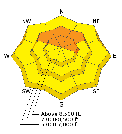
Dangerous avalanche conditions and CONSIDERABLE danger exist on drifted slopes at upper and mid elevations in the backcountry. Heavy snowfall and drifting snow will cause rising avalanche danger today. Extremely strong southwest winds overnight drifted copious snow in exposed terrain, built deep drifts and wind slabs in and around terrain features, and created heightened avalanche conditions at all elevations. Drifting overloaded slopes plagued by a deeply buried persistent weak layer, and dangerous avalanches breaking 4 to 6 feet deep on sugary faceted snow near the ground are possible on slopes facing the northern half of the compass.
  • Avoid corniced slopes and deposits of wind drifted snow in and around terrain features like sub-ridges, gullies, scoops, and cliff bands.
  • Continue to stay off and out from under northerly facing upper and mid elevation slopes steeper than 30°
Low
Moderate
Considerable
High
Extreme
Learn how to read the forecast here
Weather and Snow
South winds increased significantly overnight posting hourly average wind speeds in the 40 mph range for several hours and veering from the west with 80 and 84 mph hour gusts measured this morning at the CSI Logan Peak weather station. The Holiday storms dumped several feet of snow across the Logan Zone, and brought snow totals back up to well above normal for this time of year. There is now 58"of total snow at the 8400' Tony Grove Snotel, containing 109% of normal SWE for the date. I'm reading 25°F at Tony Grove and 15°F at the summit of Logan Peak.
Heavy snow is falling in the Bear River Range already this morning and 4 to 8 inches of accumulation is expected today on upper elevation slopes. West winds will decrease a bit this afternoon but snowfall rates will increase another notch tonight, with 9 to 13 inches possible, and yet another 8 to 12 inches tomorrow! Periods of heavy snow with drifting from fairly strong westerly wind will continue through the work week, with additional significant accumulations likely in the mountains.

We found widespread very deep snow from the series of Holiday storms in the upper Bunch Grass Area yesterday.
Recent Avalanches
We saw some fresh cornice fall off the south ridge of Magog yesterday, but no significant avalanches were yet reported in the Logan Zone in 2022. It has been very active in the Central and Southern Wasatch Range, with several recent huge avalanches from the backcountry on our updated Avalanche List..

This is from Alta on Sunday:

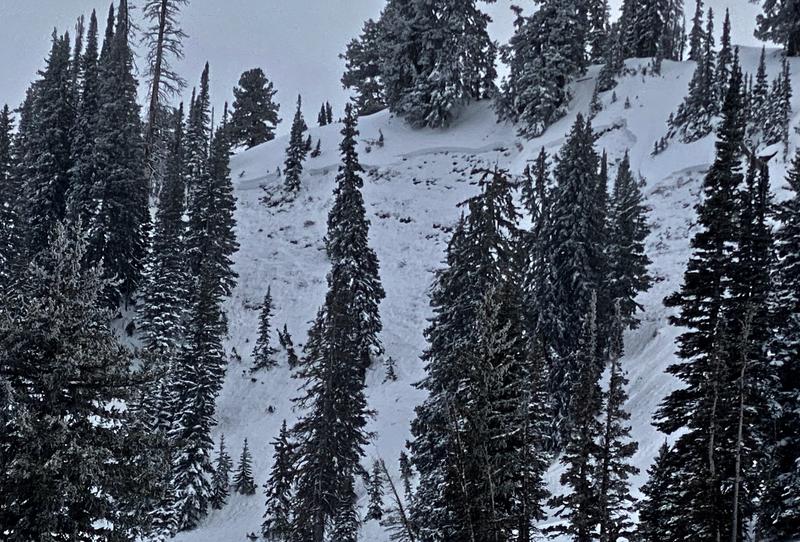
There were some natural avalanches that happened on Providence Peak last week during the Holiday storms like the one below.

Check HERE for all the latest observations and avalanche activity.
Ad
Avalanche Problem #1
Persistent Weak Layer
Type
Location
Likelihood
Size
Description
Although they have become less likely and harder to trigger, very dangerous deep hard slab avalanches failing at ground level on weak faceted snow remain possible.
I will continue to avoid mid and upper elevation northerly facing slopes and you should too. These slopes have a buried persistent weak layer of weak, sugary facets near the ground that could fracture and produce slab avalanches 4-6 feet deep and hundreds of feet across. Avalanches might be triggered remotely, from a distance or from flat terrain under steep slopes. It's a very different situation at lower elevations and on south facing slopes where this persistent weak layer near the ground doesn't exist.
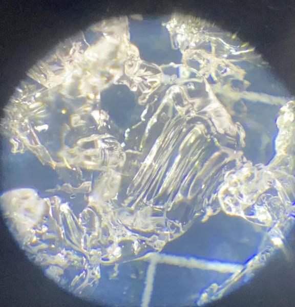
The photo below is a close up of what the faceted snow looks like. Notice the striations or straight lines that form when the snow crystals change into a weak faceted crystal. Cold temperatures like those in the last couple days cause a temperature gradient in the snowpack and these sugary snow crystals to develop. I am noticing rapid development of faceted snow at low elevations these days, especially where the existing snow is still shallow.
Avalanche Problem #2
Wind Drifted Snow
Type
Location
Likelihood
Size
Description
People could trigger slab avalanches of wind drifted snow in steep terrain at all elevations today. Southwest winds ramped up overnight, raking the fresh snow off windward slopes and depositing it, creating stiff drifts on the lee side of major ridges and in and around terrain features. Also, the southwest winds are drifting snow right onto suspect northerly facing slopes that are plagued by a persistent weak layer, increasing the load and the danger.
  • An avalanche of wind drifted snow overrunning a with a deeply buried persistent weak layer could step down, include older snow, and become much larger and more destructive.
Additional Information
  • Always follow safe backcountry travel protocols. Go one person at a time in avalanche terrain, while the rest of your party watches from a safe area.
  • Check your avalanche rescue equipment, change your batteries, and practice often with your backcountry partners.
    Check slope angles and stay off of and out from under slopes steeper than 30° and adjacent slopes.
General Announcements
Who's up for some free avalanche training? Get a refresher, become better prepared for an upcoming avalanche class, or just boost your skills. Go to https://learn.kbyg.org/ and scroll down to Step 2 for a series of interactive online avalanche courses produced by the UAC.
  • Check out all the upcoming education classes and clinics HERE.
  • Please submit your observations from the backcountry HERE.
This information does not apply to developed ski areas or highways where avalanche control is normally done. This forecast is from the U.S.D.A. Forest Service, which is solely responsible for its content. This forecast describes general avalanche conditions and local variations always occur.