Forecast for the Skyline Area Mountains

Brett Kobernik
Issued by Brett Kobernik on
Sunday morning, December 19, 2021
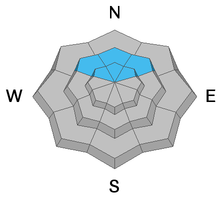
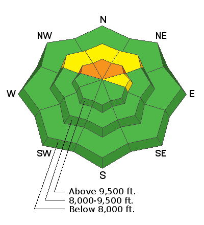
A CONSIDERABLE avalanche danger exists on slopes of 35 degrees or steeper on northwest, north and northeast facing slopes above about 9000'. Outside of that terrain, the danger is LOW.
Because the high elevation northerly facing terrain is where the most snow is, we are drawn there for winter recreation. If you are going to travel into this terrain, stick to slopes of 30 degrees in steepness or less and you'll stay out of avalanches.
Low
Moderate
Considerable
High
Extreme
Learn how to read the forecast here
Weather and Snow
Current Conditions
Riding conditions remain good with soft powder on the surface from Thursday's storm and not much wind. Overnight temperatures were in the low to mid 20s along the higher elevations.
Mountain Weather
We've got a couple more days of sunny mild weather and light wind before the pattern changes. Storms look like they will start to move in again on Thursday night. It looks like a series of smaller events. Weather models show snow amounts looking good through the end of the year although they look slightly less optimistic than a couple of days ago.
Ad
Avalanche Problem #1
Persistent Weak Layer
Type
Location
Likelihood
Size
Description
There is a buried persistent weak layer of faceted snow that can cause slab avalanches. This will be our main focus for the next few weeks. The problem exists on steep slopes above about 9000 feet that face northwest, north and northeast.