Forecast for the Provo Area Mountains

Issued by Greg Gagne on
Friday morning, December 10, 2021
Friday morning, December 10, 2021
The avalanche danger is CONSIDERABLE on mid and upper elevation aspects facing northwest through east where storm snow and fresh wind drifts are sitting on top of weak snow underneath. Human-triggered avalanches are likely and natural avalanches are possible. There is a MODERATE danger on mid and upper elevation slopes facing west through south and southeast where avalanches involving storm snow and wind-drifted snow are possible. Low elevations have a Low danger as there currently isn't enough snow coverage.
Being caught in any avalanche occurrence will have significant consequences as it will involve hitting rocks, stumps, and downed trees.

Low
Moderate
Considerable
High
Extreme
Learn how to read the forecast here
 Special Announcements
This week is the third annual Avalanche Awareness Week in Utah. A lot is going on with over 20 different events around the state. You can find all the events HERE.
Batteries for Beacons runs through Dec 19. Get free batteries for your transceiver and a chance to win 1 of 10 Black Diamond Rescue Kits, 1 of 3 Mammut Barryvox transceivers, or 1 of 3 BCA Tracker transceivers. Stop at a participating shop, fill out our survey and get a free set of batteries. Don't need batteries, but still want a chance to win? Simply fill out the survey to be registered.
 Weather and Snow
Currently - Temperatures are a few degrees on either side of 0° F and winds are out of the west/northwest. Between 9,500' and 10,500', winds are averaging in the teens with gusts in the 20's mph. At 11,000' winds are much stronger, averaging in the 40's with gusts in the 50's mph.
Snowfall began around 6 am on Thursday morning with approximate 24-hour snow totals in the Provo mountains with up to 18" of snow containing 1.8" of water. Further to the north, snow amounts include:
Little Cottonwood Canyon -18" snow (1.4" water)
Big Cottonwood Canyon - 12-18" snow (1.2" water)
Park City Ridgeline - 12-14" snow (0.9" water)
For today, the Provo mountains are forecasted to receive 2-4" of snow. Along the upper-most ridges and peaks at 11,000', winds winds will average in the 20's and 30's mph, with gusts in the 50's. Temperatures will rise to the high single digits and low teens. Welcome to Winter!
Today's storm track is on a northwest flow and the Provo mountains will be shielded from the bulk of the precipitation. Further to the north, the Cottonwood Canyons should do quite well with periods of higher precipitation intensity likely. In areas favored by a northwest flow (such as Little Cottonwood Canyon), snow totals could easily exceed a foot before snowfall diminishes late afternoon. .
 Recent Avalanches
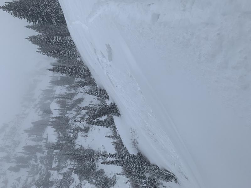
We received no backcountry observations from the Provo mountains. Several avalanches were reported from the Salt Lake mountains on Thursday, especially in Grizzly Gulch where several avalanche classes were being held, treating students to a firsthand experience of observing avalanche activity. (Colby Stetson photo). These included natural avalanches and remotely-triggered avalanches. There were also natural and remotely-triggered avalanches reported reported from the Park City ridgeline. Snow safety teams from Cottonwood resorts reported avalanche activity involving long-running dry-loose avalanches as well as sensitive soft slabs.
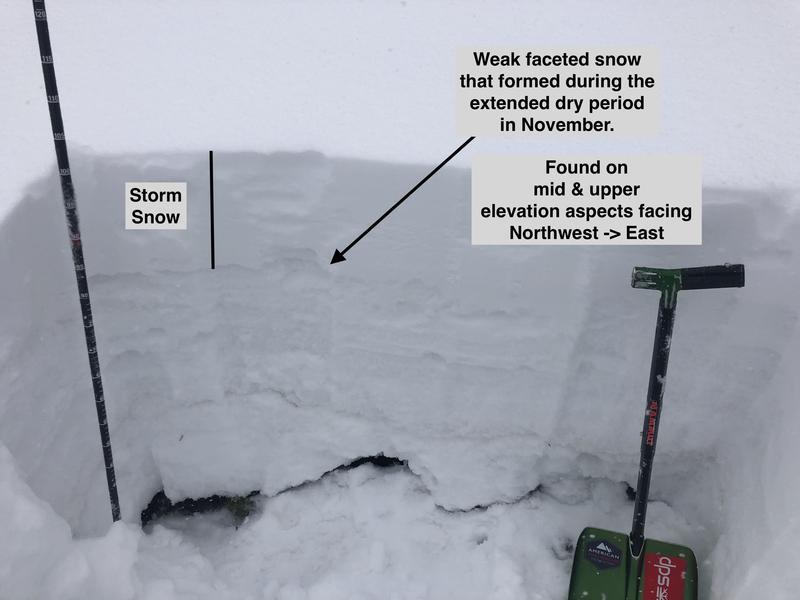
Avalanches were failing at density changes within the storm snow as well as the interface of new and old snow where the snow snow was falling on a weak layer of faceted snow that formed during the extended period of dry weather in November.

Be sure to regularly check the observations page for field observations as well as avalanche activity.
Avalanche Problem #1
New Snow
Type
Location

Likelihood
Size
Description
With additional snow forecasted for today, avalanches in the storm snow are possible, including long-running sluffs and sensitive soft slabs, especially during any period of higher precipitation intensity. On mid and upper elevation slopes facing northwest through east, avalanches are likely to fail at the interface of the old snow surface which had become weak and faceted during the November dry spell. Avalanches may be up to 18" deep and may be triggered remotely (from a distance).
Widespread variability in the old snow surface further complicates snowpack evaluation where there may be a disparity between two slopes with similar aspects and elevations: one slope may not have faceted snow underneath; the other holding a dangerous layer of weak facets. I personally am avoiding being on or underneath any slope steeper than 30 degrees on mid and upper elevation aspects facing northwest through east.
Fortunately, the low-density snow makes for good riding conditions on lower-angled slopes.
The image below illustrates the faceted snow that can be found on northerly aspects and is now buried underneath the storm snow.

Avalanche Problem #2
Wind Drifted Snow
Type
Location

Likelihood
Size
Description
West /northwest winds increased overnight, and with plenty of loose snow available for transport, pockets of fresh, sensitive wind drifts are likely along upper elevation ridges and in open bowls. Some drifts may have formed on top of the weak facets that are prevalent on mid and upper elevation slopes facing northwest through east. A common theme from avalanche activity on Thursday involved slopes that had some wind-drifting, creating a more cohesive, sensitive slab.
General Announcements
This information does not apply to developed ski areas or highways where avalanche control is normally done. This forecast is from the U.S.D.A. Forest Service, which is solely responsible for its content. This forecast describes general avalanche conditions and local variations always occur.


